Shenavan geodata
Shenavan (Armavir) is a populated place; located in Armenia in Asia/Yerevan (GMT+4) time zone. With population of 1,757 people, there are 186 cities with bigger population in this country. Compared to other cities in Armenia, 75.5% of cities are located further ↑North; 93.3% of cities are located further →East and 66.6% of cities have higher elevation than Shenavan. Note1


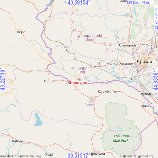
Shenavan GPS coordinates[2]
40° 3' 19.728" North, 43° 55' 49.728" East
| Map corner | latitude | longitude |
|---|---|---|
| Upper-left | 40.59154°, | 43.22736° |
| Center: | 40.05548°, | 43.93048° |
| Lower-right: | 39.51517°, | 44.63361° |
| Map W x H: | 119.7×119.7 km | = 74.4×74.4mi |
| max Lat: | 41.24358° ⇑75.5% North |
| Shenavan: | 40.05548° |
| min Lat: | ⇓24.5% South 38.90292° |
| min Long | Shenavan | max Long |
| 43.74722° | 43.93048° | 46.5446° |
| W 6.7%⇐ | ⇒93.3% E |
Elevation
Elevation of Shenavan is 896 m = 2940 ft, and this is 405.5 m = 1330 ft below average elevation for this country.
| Max E: |
2169 m = 7116 ft | 66.6% |
| Avg. | 1301.5 m = 4270 ft | |
| Shenavan | 896 m = 2940 ft | |
Min E: |
440 m = 1444 ft | 33.4% |
See also: Armenia elevation on elevation.city.
Geographical zone
Shenavan is located in North temperate zone (between Tropic of Cancer and the Arctic Circle). Distance of this Northern Tropic circle is 1847.8 km =1148.2 mi to South.| Distance of | km | miles | from Shenavan |
|---|---|---|---|
| North Pole | 5553.3 | 3450.7 | to North |
| Arctic Circle | 2947.4 | 1831.4 | to North |
| Tropic Cancer | 1847.8 | 1148.2 | to South |
| Equator | 4453.8 | 2767.5 | to South |


Nearby cities:
15 places around Shenavan: (largest is in red/bold)
• Alashkert
11.8 km =7.3 mi,  60°
60°
• Arevik
14.8 km =9.2 mi,  70°
70°
• Argavand
14 km =8.7 mi,  87°
87°
• Armavir
14.3 km =8.9 mi,  39°
39°
• Aygeshat
11.3 km =7 mi,  78°
78°
• Bambakashat
9.6 km =6 mi,  52°
52°
• Getashen
1.6 km =1 mi,  141°
141°
• Janfida
8.4 km =5.2 mi,  98°
98°
• Lenughi
8.2 km =5.1 mi,  20°
20°
• Myasnikyan
13.9 km =8.6 mi,  356°
356°
• Nalbandyan
5.1 km =3.2 mi, 79°
• Nor Armavir
6.4 km =4 mi, 57°
• P’shatavan
11.7 km =7.3 mi, 99°
• Sardarapat
10.9 km =6.8 mi, 38°
• Tandzut
12.6 km =7.8 mi, 82°
Sources, notices
• [Note1] Compared only with cities in Armenia existing in our database
• [Src1] Map data: © OpenStreetMap contributors (CC-BY-SA)
• [Src2] Other city data from geonames.org with taken over terms of usage.
• [Src3] Geographical zone / Annual Mean Temperature by Robert A. Rohde @ Wikipedia
