Meghrashen geodata
Meghrashen (Shirak) is a populated place; located in Armenia in Asia/Yerevan (GMT+4) time zone. With population of 1,107 people, there are 285 cities with bigger population in this country. Compared to other cities in Armenia, 78% of cities are located further ↓South; 91.7% of cities are located further →East and 73.9% of cities have lower elevation than Meghrashen. Note1


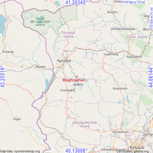
Meghrashen GPS coordinates[2]
40° 40' 20.28" North, 43° 57' 29.916" East
| Map corner | latitude | longitude |
|---|---|---|
| Upper-left | 41.20345°, | 43.25519° |
| Center: | 40.6723°, | 43.95831° |
| Lower-right: | 40.13688°, | 44.66144° |
| Map W x H: | 118.6×118.6 km | = 73.7×73.7mi |
| max Lat: | 41.24358° ⇑22% North |
| Meghrashen: | 40.6723° |
| min Lat: | ⇓78% South 38.90292° |
| min Long | Meghrashen | max Long |
| 43.74722° | 43.95831° | 46.5446° |
| W 8.3%⇐ | ⇒91.7% E |
Elevation
Elevation of Meghrashen is 1664 m = 5459 ft, and this is 362.5 m = 1189 ft above average elevation for this country.
| Max E: |
2169 m = 7116 ft | 26.1% |
| Meghrashen | 1664 m 5459 ft | |
| Avg. | 1301.5 m = 4270 ft | |
Min E: |
440 m = 1444 ft | 73.9% |
See also: Armenia elevation on elevation.city.
Geographical zone
Meghrashen is located in North temperate zone (between Tropic of Cancer and the Arctic Circle). Distance of this Northern Tropic circle is 1916.4 km =1190.8 mi to South.| Distance of | km | miles | from Meghrashen |
|---|---|---|---|
| North Pole | 5484.7 | 3408 | to North |
| Arctic Circle | 2878.8 | 1788.8 | to North |
| Tropic Cancer | 1916.4 | 1190.8 | to South |
| Equator | 4522.3 | 2810 | to South |


Nearby cities:
15 places around Meghrashen: (largest is in red/bold)
• Akhuryan
12.9 km =8 mi,  337°
337°
• Anushavan
3.1 km =1.9 mi,  142°
142°
• Arevik
9 km =5.6 mi,  329°
329°
• Arevshat
7.5 km =4.7 mi,  106°
106°
• Azatan
12.2 km =7.6 mi,  295°
295°
• Basen
9.9 km =6.2 mi,  16°
16°
• Hnaberd
15.9 km =9.9 mi,  104°
104°
• Horrom
5.9 km =3.7 mi,  256°
256°
• Lerrnakert
12.3 km =7.6 mi,  187°
187°
• Maralik
13 km =8.1 mi,  213°
213°
• Mets Mant’ash
8.9 km =5.5 mi, 110°
• Pemzashen
9.7 km =6 mi, 187°
• P’ok’r Mant’ash
8.3 km =5.2 mi,  115°
115°
• Saratak
7.3 km =4.5 mi,  268°
268°
• Spandaryan
5 km =3.1 mi, 104°
Sources, notices
• [Note1] Compared only with cities in Armenia existing in our database
• [Src1] Map data: © OpenStreetMap contributors (CC-BY-SA)
• [Src2] Other city data from geonames.org with taken over terms of usage.
• [Src3] Geographical zone / Annual Mean Temperature by Robert A. Rohde @ Wikipedia
