P’ok’r Mant’ash geodata
P’ok’r Mant’ash (Shirak) is a populated place; located in Armenia in Asia/Yerevan (GMT+4) time zone. With population of 1,838 people, there are 177 cities with bigger population in this country. Compared to other cities in Armenia, 75.8% of cities are located further ↓South; 87.6% of cities are located further →East and 93.9% of cities have lower elevation than P’ok’r Mant’ash. Note1


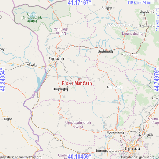
P’ok’r Mant’ash GPS coordinates[2]
40° 38' 24.936" North, 44° 2' 47.976" East
| Map corner | latitude | longitude |
|---|---|---|
| Upper-left | 41.17167°, | 43.34354° |
| Center: | 40.64026°, | 44.04666° |
| Lower-right: | 40.10459°, | 44.74979° |
| Map W x H: | 118.6×118.6 km | = 73.7×73.7mi |
| max Lat: | 41.24358° ⇑24.2% North |
| P’ok’r Mant’ash: | 40.64026° |
| min Lat: | ⇓75.8% South 38.90292° |
| min Long | P’ok’r Mant | max Long |
| 43.74722° | 44.04666° | 46.5446° |
| W 12.4%⇐ | ⇒87.6% E |
Elevation
Elevation of P’ok’r Mant’ash is 1977 m = 6486 ft, and this is 675.5 m = 2216 ft above average elevation for this country.
| Max E: |
2169 m = 7116 ft | 6.1% |
| P’ok’r Mant’ash | 1977 m 6486 ft | |
| Avg. | 1301.5 m = 4270 ft | |
Min E: |
440 m = 1444 ft | 93.9% |
See also: Armenia elevation on elevation.city.
Geographical zone
P’ok’r Mant’ash is located in North temperate zone (between Tropic of Cancer and the Arctic Circle). Distance of this Northern Tropic circle is 1912.9 km =1188.6 mi to South.| Distance of | km | miles | from P’ok’r Mant’ash |
|---|---|---|---|
| North Pole | 5488.3 | 3410.3 | to North |
| Arctic Circle | 2882.4 | 1791 | to North |
| Tropic Cancer | 1912.9 | 1188.6 | to South |
| Equator | 4518.8 | 2807.9 | to South |


Nearby cities:
15 places around P’ok’r Mant’ash: (largest is in red/bold)
• Anushavan
5.7 km =3.5 mi,  281°
281°
• Arevik
16.5 km =10.3 mi,  313°
313°
• Arevshat
1.5 km =0.9 mi,  351°
351°
• Basen
13.8 km =8.6 mi,  340°
340°
• Hnaberd
7.9 km =4.9 mi,  92°
92°
• Horrom
13.4 km =8.3 mi, 279°
• Lerrnakert
12.6 km =7.8 mi,  226°
226°
• Maralik
16.4 km =10.2 mi,  243°
243°
• Meghrashen
8.3 km =5.2 mi,  295°
295°
• Mets Mant’ash
0.9 km =0.6 mi,  64°
64°
• Pemzashen
10.6 km =6.6 mi, 235°
• Saratak
15.1 km =9.4 mi, 283°
• Spandaryan
3.5 km =2.2 mi, 311°
• Tsaghkaber
18.2 km =11.3 mi,  14°
14°
• Tsaghkahovit
14.8 km =9.2 mi, 92°
Sources, notices
• [Note1] Compared only with cities in Armenia existing in our database
• [Src1] Map data: © OpenStreetMap contributors (CC-BY-SA)
• [Src2] Other city data from geonames.org with taken over terms of usage.
• [Src3] Geographical zone / Annual Mean Temperature by Robert A. Rohde @ Wikipedia
