Myasnikyan geodata
Myasnikyan (Armavir) is a populated place; located in Armenia in Asia/Yerevan (GMT+4) time zone. With population of 3,458 people, there are 78 cities with bigger population in this country. Compared to other cities in Armenia, 54.5% of cities are located further ↑North; 93.6% of cities are located further →East and 66.2% of cities have higher elevation than Myasnikyan. Note1


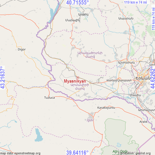
Myasnikyan GPS coordinates[2]
40° 10' 49.728" North, 43° 55' 10.164" East
| Map corner | latitude | longitude |
|---|---|---|
| Upper-left | 40.71555°, | 43.21637° |
| Center: | 40.18048°, | 43.91949° |
| Lower-right: | 39.64116°, | 44.62262° |
| Map W x H: | 119.5×119.5 km | = 74.3×74.3mi |
| max Lat: | 41.24358° ⇑54.5% North |
| Myasnikyan: | 40.18048° |
| min Lat: | ⇓45.5% South 38.90292° |
| min Long | Myasnikyan | max Long |
| 43.74722° | 43.91949° | 46.5446° |
| W 6.4%⇐ | ⇒93.6% E |
Elevation
Elevation of Myasnikyan is 906 m = 2972 ft, and this is 395.5 m = 1298 ft below average elevation for this country.
| Max E: |
2169 m = 7116 ft | 66.2% |
| Avg. | 1301.5 m = 4270 ft | |
| Myasnikyan | 906 m = 2972 ft | |
Min E: |
440 m = 1444 ft | 33.8% |
See also: Armenia elevation on elevation.city.
Geographical zone
Myasnikyan is located in North temperate zone (between Tropic of Cancer and the Arctic Circle). Distance of this Northern Tropic circle is 1861.7 km =1156.8 mi to South.| Distance of | km | miles | from Myasnikyan |
|---|---|---|---|
| North Pole | 5539.4 | 3442 | to North |
| Arctic Circle | 2933.5 | 1822.8 | to North |
| Tropic Cancer | 1861.7 | 1156.8 | to South |
| Equator | 4467.7 | 2776.1 | to South |


Nearby cities:
15 places around Myasnikyan: (largest is in red/bold)
• Alashkert
13.8 km =8.6 mi,  126°
126°
• Armavir
10.5 km =6.5 mi,  106°
106°
• Ashnak
16.7 km =10.4 mi,  359°
359°
• Aygeshat
16.8 km =10.4 mi, 134°
• Bambakashat
11.7 km =7.3 mi, 133°
• Dalarik
6.3 km =3.9 mi,  326°
326°
• Getashen
15.2 km =9.4 mi,  172°
172°
• Lenughi
7.2 km =4.5 mi,  148°
148°
• Lukashin
7.2 km =4.5 mi,  83°
83°
• Mayisyan
14.9 km =9.3 mi,  100°
100°
• Mrgashat
14.8 km =9.2 mi, 112°
• Nalbandyan
14.2 km =8.8 mi,  155°
155°
• Nor Armavir
12.3 km =7.6 mi, 148°
• Sardarapat
9.4 km =5.8 mi, 125°
• Shenavan
13.9 km =8.6 mi,  176°
176°
Sources, notices
• [Note1] Compared only with cities in Armenia existing in our database
• [Src1] Map data: © OpenStreetMap contributors (CC-BY-SA)
• [Src2] Other city data from geonames.org with taken over terms of usage.
• [Src3] Geographical zone / Annual Mean Temperature by Robert A. Rohde @ Wikipedia
