El Soberbio geodata
El Soberbio (Misiones) is a seat of a second-order administrative division; located in Argentina in America/Argentina/Cordoba (GMT-3) time zone. With population of 19,571 people, there are 190 cities with bigger population in this country. Compared to other cities in Argentina, 83.4% of cities are located further ↓South; 99.7% of cities are located further ←West and 51.5% of cities have lower elevation than El Soberbio. Note1


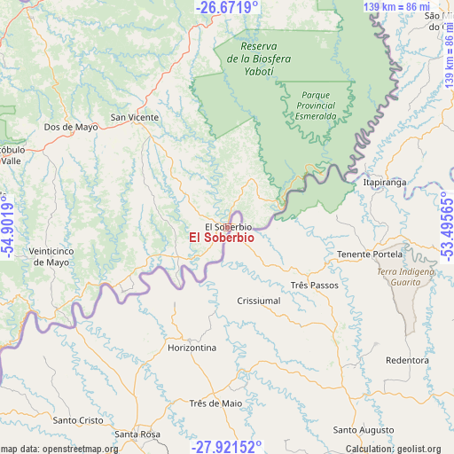
El Soberbio GPS coordinates[2]
27° 17' 54.492" South, 54° 11' 55.572" West
| Map corner | latitude | longitude |
|---|---|---|
| Upper-left | -26.6719°, | -54.9019° |
| Center: | -27.29847°, | -54.19877° |
| Lower-right: | -27.92152°, | -53.49565° |
| Map W x H: | 138.9×138.9 km | = 86.3×86.3mi |
| max Lat: | -21.94467° ⇑16.6% North |
| El Soberbio: | -27.29847° |
| min Lat: | ⇓83.4% South -54.81084° |
| min Long | El Soberbio | max Long |
| -72.88605° | -54.19877° | -53.64581° |
| W 99.7%⇐ | ⇒0.3% E |
Elevation
Elevation of El Soberbio is 156 m = 512 ft, and this is 193.3 m = 634 ft below average elevation for this country.
| Max E: |
4040 m = 13255 ft | 48.5% |
| Avg. | 349.3 m = 1146 ft | |
| El Soberbio | 156 m = 512 ft | |
Min E: |
-2 m = -7 ft | 51.5% |
See also: Argentina elevation on elevation.city.
Geographical zone
El Soberbio is located in South temperate zone (between Tropic of Capricorn and the Antarctic Circle). Distance of this Southern Tropic circle is 429.4 km =266.8 mi to North.| Distance of | km | miles | from El Soberbio |
|---|---|---|---|
| Equator | 3035.3 | 1886 | to North |
| Tropic Capricorn | 429.4 | 266.8 | to North |
| Antarctic Circle | 4365.9 | 2712.8 | to South |
| South Pole | 6971.8 | 4332.1 | to South |


Nearby cities:
15 places around El Soberbio: (largest is in red/bold)
• Alba Posse
56.5 km =35.1 mi,  237°
237°
• Aristóbulo del Valle
72.6 km =45.1 mi,  288°
288°
• Campo Grande
77.9 km =48.4 mi,  277°
277°
• Campo Ramón
83 km =51.6 mi,  257°
257°
• Campo Viera
84.8 km =52.7 mi,  267°
267°
• Colonia Aurora
37.7 km =23.4 mi, 238°
• Dos de Mayo
57.2 km =35.5 mi,  302°
302°
• El Alcázar
89.1 km =55.4 mi,  316°
316°
• Garuhapé
92.1 km =57.2 mi,  305°
305°
• Los Helechos
91.3 km =56.7 mi,  252°
252°
• Panambí
85 km =52.8 mi, 236°
• Ruiz de Montoya
91.2 km =56.7 mi, 292°
• San Pedro
75.7 km =47 mi,  6°
6°
• San Vicente
76.1 km =47.3 mi,  4°
4°
• Veinticinco de Mayo
54.5 km =33.9 mi, 260°
Sources, notices
• [Note1] Compared only with cities in Argentina existing in our database
• [Src1] Map data: © OpenStreetMap contributors (CC-BY-SA)
• [Src2] Other city data from geonames.org with taken over terms of usage.
• [Src3] Geographical zone / Annual Mean Temperature by Robert A. Rohde @ Wikipedia
