San Pedro geodata
San Pedro (Buenos Aires) is a seat of a second-order administrative division; located in Argentina in America/Argentina/Buenos_Aires (GMT-3) time zone. With population of 47,452 people, there are 93 cities with bigger population in this country. Compared to other cities in Argentina, 67.6% of cities are located further ↑North; 70.5% of cities are located further ←West and 89.2% of cities have higher elevation than San Pedro. Note1


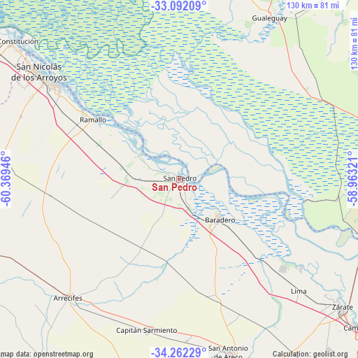
San Pedro GPS coordinates[2]
33° 40' 45.048" South, 59° 39' 58.788" West
| Map corner | latitude | longitude |
|---|---|---|
| Upper-left | -33.09209°, | -60.36946° |
| Center: | -33.67918°, | -59.66633° |
| Lower-right: | -34.26229°, | -58.96321° |
| Map W x H: | 130.1×130.1 km | = 80.8×80.8mi |
| max Lat: | -21.94467° ⇑67.6% North |
| San Pedro: | -33.67918° |
| min Lat: | ⇓32.4% South -54.81084° |
| min Long | San Pedro | max Long |
| -72.88605° | -59.66633° | -53.64581° |
| W 70.5%⇐ | ⇒29.5% E |
Elevation
Elevation of San Pedro is 30 m = 98 ft, and this is 319.3 m = 1048 ft below average elevation for this country.
| Max E: |
4040 m = 13255 ft | 89.2% |
| Avg. | 349.3 m = 1146 ft | |
| San Pedro | 30 m = 98 ft | |
Min E: |
-2 m = -7 ft | 10.8% |
See also: San Pedro elevation on elevation.city.
Geographical zone
San Pedro is located in South temperate zone (between Tropic of Capricorn and the Antarctic Circle). Distance of this Southern Tropic circle is 1138.9 km =707.7 mi to North.| Distance of | km | miles | from San Pedro |
|---|---|---|---|
| Equator | 3744.8 | 2326.9 | to North |
| Tropic Capricorn | 1138.9 | 707.7 | to North |
| Antarctic Circle | 3656.4 | 2272 | to South |
| South Pole | 6262.3 | 3891.2 | to South |


Nearby cities:
15 places around San Pedro: (largest is in red/bold)
• Arrecifes
58.8 km =36.5 mi,  223°
223°
• Baradero
20.7 km =12.9 mi,  135°
135°
• Campana
84.6 km =52.6 mi,  129°
129°
• Capilla del Señor
85.7 km =53.3 mi, 142°
• Capitán Sarmiento
56 km =34.8 mi,  191°
191°
• Carmen de Areco
79 km =49.1 mi, 190°
• Gualeguay
68.3 km =42.4 mi,  28°
28°
• Pergamino
87.1 km =54.1 mi,  254°
254°
• Puerto Ibicuy
45.9 km =28.5 mi,  100°
100°
• Ramallo
38.2 km =23.7 mi,  304°
304°
• Salto
87.2 km =54.2 mi, 218°
• San Antonio de Areco
66 km =41 mi,  164°
164°
• San Nicolás de los Arroyos
63.4 km =39.4 mi,  307°
307°
• Villa Constitución
79.4 km =49.3 mi, 309°
• Zárate
75.1 km =46.7 mi, 128°
Sources, notices
• [Note1] Compared only with cities in Argentina existing in our database
• [Src1] Map data: © OpenStreetMap contributors (CC-BY-SA)
• [Src2] Other city data from geonames.org with taken over terms of usage.
• [Src3] Geographical zone / Annual Mean Temperature by Robert A. Rohde @ Wikipedia
