Loreto geodata
Loreto (Misiones) is a populated place; located in Argentina in America/Argentina/Cordoba (GMT-3) time zone. With population of 1,201 people, there are 739 cities with bigger population in this country. Compared to other cities in Argentina, 83% of cities are located further ↓South; 95.2% of cities are located further ←West and 55.1% of cities have lower elevation than Loreto. Note1


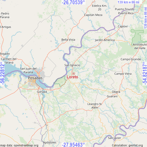
Loreto GPS coordinates[2]
27° 19' 54.372" South, 55° 31' 29.964" West
| Map corner | latitude | longitude |
|---|---|---|
| Upper-left | -26.70539°, | -56.22812° |
| Center: | -27.33177°, | -55.52499° |
| Lower-right: | -27.95463°, | -54.82187° |
| Map W x H: | 138.9×138.9 km | = 86.3×86.3mi |
| max Lat: | -21.94467° ⇑17% North |
| Loreto: | -27.33177° |
| min Lat: | ⇓83% South -54.81084° |
| min Long | Loreto | max Long |
| -72.88605° | -55.52499° | -53.64581° |
| W 95.2%⇐ | ⇒4.8% E |
Elevation
Elevation of Loreto is 173 m = 568 ft, and this is 176.3 m = 578 ft below average elevation for this country.
| Max E: |
4040 m = 13255 ft | 44.9% |
| Avg. | 349.3 m = 1146 ft | |
| Loreto | 173 m = 568 ft | |
Min E: |
-2 m = -7 ft | 55.1% |
See also: Argentina elevation on elevation.city.
Geographical zone
Loreto is located in South temperate zone (between Tropic of Capricorn and the Antarctic Circle). Distance of this Southern Tropic circle is 433.1 km =269.1 mi to North.| Distance of | km | miles | from Loreto |
|---|---|---|---|
| Equator | 3039 | 1888.3 | to North |
| Tropic Capricorn | 433.1 | 269.1 | to North |
| Antarctic Circle | 4362.2 | 2710.5 | to South |
| South Pole | 6968.1 | 4329.8 | to South |


Nearby cities:
15 places around Loreto: (largest is in red/bold)
• Almafuerte
23 km =14.3 mi,  148°
148°
• Bonpland
17.4 km =10.8 mi,  164°
164°
• Candelaria
26 km =16.2 mi,  236°
236°
• Cerro Azul
33.6 km =20.9 mi,  175°
175°
• Cerro Corá
21.8 km =13.5 mi,  202°
202°
• Garupá
34.3 km =21.3 mi, 240°
• General Alvear
36.7 km =22.8 mi,  106°
106°
• Gobernador Roca
17.2 km =10.7 mi,  20°
20°
• Guaraní
41.8 km =26 mi,  120°
120°
• Leandro N. Alem
36.1 km =22.4 mi, 146°
• Mártires
17.8 km =11.1 mi, 124°
• Posadas
36.9 km =22.9 mi,  263°
263°
• San Ignacio
8.5 km =5.3 mi,  354°
354°
• Santa Ana
6.8 km =4.2 mi,  234°
234°
• Santo Pipó
24.1 km =15 mi,  28°
28°
Sources, notices
• [Note1] Compared only with cities in Argentina existing in our database
• [Src1] Map data: © OpenStreetMap contributors (CC-BY-SA)
• [Src2] Other city data from geonames.org with taken over terms of usage.
• [Src3] Geographical zone / Annual Mean Temperature by Robert A. Rohde @ Wikipedia
