Ituzaingó geodata
Ituzaingó (Corrientes) is a seat of a second-order administrative division; located in Argentina in America/Argentina/Cordoba (GMT-3) time zone. In our database, there are 785 cities with bigger population. Compared to other cities in Argentina, 79% of cities are located further ↓South; 93.5% of cities are located further ←West and 70.9% of cities have higher elevation than Ituzaingó. Note1


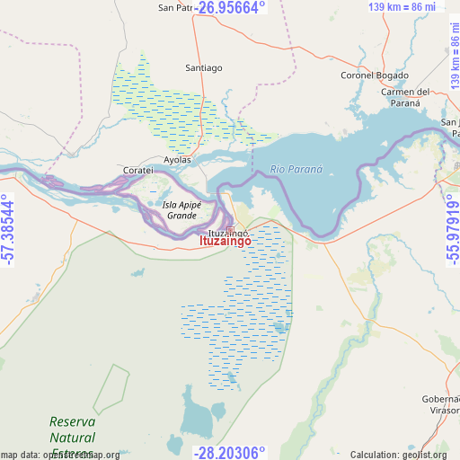
Ituzaingó GPS coordinates[2]
27° 34' 53.832" South, 56° 40' 56.316" West
| Map corner | latitude | longitude |
|---|---|---|
| Upper-left | -26.95664°, | -57.38544° |
| Center: | -27.58162°, | -56.68231° |
| Lower-right: | -28.20306°, | -55.97919° |
| Map W x H: | 138.6×138.6 km | = 86.1×86.1mi |
| max Lat: | -21.94467° ⇑21% North |
| Ituzaingó: | -27.58162° |
| min Lat: | ⇓79% South -54.81084° |
| min Long | Ituzaingó | max Long |
| -72.88605° | -56.68231° | -53.64581° |
| W 93.5%⇐ | ⇒6.5% E |
Elevation
Elevation of Ituzaingó is 78 m = 256 ft, and this is 271.3 m = 890 ft below average elevation for this country.
| Max E: |
4040 m = 13255 ft | 70.9% |
| Avg. | 349.3 m = 1146 ft | |
| Ituzaingó | 78 m = 256 ft | |
Min E: |
-2 m = -7 ft | 29.1% |
See also: Argentina elevation on elevation.city.
Geographical zone
Ituzaingó is located in South temperate zone (between Tropic of Capricorn and the Antarctic Circle). Distance of this Southern Tropic circle is 460.9 km =286.4 mi to North.| Distance of | km | miles | from Ituzaingó |
|---|---|---|---|
| Equator | 3066.8 | 1905.6 | to North |
| Tropic Capricorn | 460.9 | 286.4 | to North |
| Antarctic Circle | 4334.4 | 2693.3 | to South |
| South Pole | 6940.3 | 4312.5 | to South |


Nearby cities:
15 places around Ituzaingó: (largest is in red/bold)
• Apóstoles
98.6 km =61.3 mi,  112°
112°
• Azara
112.3 km =69.8 mi,  118°
118°
• Berón de Astrada
84.1 km =52.3 mi,  272°
272°
• Candelaria
93.4 km =58 mi,  81°
81°
• Cerro Corá
106.1 km =65.9 mi,  85°
85°
• Garupá
84.8 km =52.7 mi, 82°
• Gobernador Virasora
82.4 km =51.2 mi,  129°
129°
• Itá Ibaté
66.9 km =41.6 mi,  285°
285°
• Loreto
62 km =38.5 mi,  250°
250°
• Nuestra Señora del Rosario de Caa Catí
94.3 km =58.6 mi,  258°
258°
• Posadas
81.1 km =50.4 mi,  72°
72°
• San Carlos
79.4 km =49.3 mi,  103°
103°
• San José
91 km =56.5 mi, 103°
• San Miguel
100.4 km =62.4 mi,  242°
242°
• Santa Ana
111.2 km =69.1 mi, 77°
Sources, notices
• [Note1] Compared only with cities in Argentina existing in our database
• [Src1] Map data: © OpenStreetMap contributors (CC-BY-SA)
• [Src2] Other city data from geonames.org with taken over terms of usage.
• [Src3] Geographical zone / Annual Mean Temperature by Robert A. Rohde @ Wikipedia
