Berón de Astrada geodata
Berón de Astrada (Corrientes) is a seat of a second-order administrative division; located in Argentina in America/Argentina/Cordoba (GMT-3) time zone. In our database, there are 785 cities with bigger population. Compared to other cities in Argentina, 79.6% of cities are located further ↓South; 91.5% of cities are located further ←West and 70.4% of cities have higher elevation than Berón de Astrada. Note1


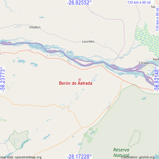
Berón de Astrada GPS coordinates[2]
27° 33' 2.412" South, 57° 32' 4.56" West
| Map corner | latitude | longitude |
|---|---|---|
| Upper-left | -26.92552°, | -58.23773° |
| Center: | -27.55067°, | -57.5346° |
| Lower-right: | -28.17228°, | -56.83148° |
| Map W x H: | 138.6×138.6 km | = 86.1×86.1mi |
| max Lat: | -21.94467° ⇑20.4% North |
| Berón de Astrada: | -27.55067° |
| min Lat: | ⇓79.6% South -54.81084° |
| min Long | Berón de Astra | max Long |
| -72.88605° | -57.5346° | -53.64581° |
| W 91.5%⇐ | ⇒8.5% E |
Elevation
Elevation of Berón de Astrada is 79 m = 259 ft, and this is 270.3 m = 887 ft below average elevation for this country.
| Max E: |
4040 m = 13255 ft | 70.4% |
| Avg. | 349.3 m = 1146 ft | |
| Berón de Astrada | 79 m = 259 ft | |
Min E: |
-2 m = -7 ft | 29.6% |
See also: Argentina elevation on elevation.city.
Geographical zone
Berón de Astrada is located in South temperate zone (between Tropic of Capricorn and the Antarctic Circle). Distance of this Southern Tropic circle is 457.4 km =284.2 mi to North.| Distance of | km | miles | from Berón de Astrada |
|---|---|---|---|
| Equator | 3063.3 | 1903.4 | to North |
| Tropic Capricorn | 457.4 | 284.2 | to North |
| Antarctic Circle | 4337.8 | 2695.4 | to South |
| South Pole | 6943.7 | 4314.6 | to South |


Nearby cities:
15 places around Berón de Astrada: (largest is in red/bold)
• Concepción
99.7 km =62 mi,  200°
200°
• Herlitzka
71.1 km =44.2 mi,  268°
268°
• Itatí
76.7 km =47.7 mi,  293°
293°
• Ituzaingó
84.1 km =52.3 mi,  92°
92°
• Itá Ibaté
23.9 km =14.9 mi,  54°
54°
• Lomas de Vallejos
43 km =26.7 mi,  241°
241°
• Loreto
35.2 km =21.9 mi,  133°
133°
• Mburucuyá
87.6 km =54.4 mi,  231°
231°
• Nuestra Señora del Rosario de Caa Catí
23.8 km =14.8 mi, 200°
• Palmar Grande
56.5 km =35.1 mi,  219°
219°
• Ramada Paso
78.4 km =48.7 mi, 285°
• San Cosme
98.5 km =61.2 mi,  281°
281°
• San Luis del Palmar
100.7 km =62.6 mi, 272°
• San Miguel
49.8 km =30.9 mi,  186°
186°
• Santa Rosa
97.8 km =60.8 mi, 215°
Sources, notices
• [Note1] Compared only with cities in Argentina existing in our database
• [Src1] Map data: © OpenStreetMap contributors (CC-BY-SA)
• [Src2] Other city data from geonames.org with taken over terms of usage.
• [Src3] Geographical zone / Annual Mean Temperature by Robert A. Rohde @ Wikipedia
