San Miguel geodata
San Miguel (Corrientes) is a seat of a second-order administrative division; located in Argentina in America/Argentina/Cordoba (GMT-3) time zone. With population of 7,396 people, there are 352 cities with bigger population in this country. Compared to other cities in Argentina, 74.7% of cities are located further ↓South; 91.3% of cities are located further ←West and 69.6% of cities have higher elevation than San Miguel. Note1


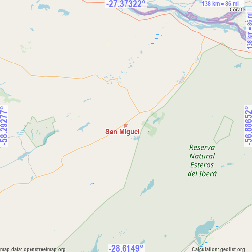
San Miguel GPS coordinates[2]
27° 59' 45.06" South, 57° 35' 22.704" West
| Map corner | latitude | longitude |
|---|---|---|
| Upper-left | -27.37322°, | -58.29277° |
| Center: | -27.99585°, | -57.58964° |
| Lower-right: | -28.6149°, | -56.88652° |
| Map W x H: | 138.1×138.1 km | = 85.8×85.8mi |
| max Lat: | -21.94467° ⇑25.3% North |
| San Miguel: | -27.99585° |
| min Lat: | ⇓74.7% South -54.81084° |
| min Long | San Miguel | max Long |
| -72.88605° | -57.58964° | -53.64581° |
| W 91.3%⇐ | ⇒8.7% E |
Elevation
Elevation of San Miguel is 80 m = 262 ft, and this is 269.3 m = 884 ft below average elevation for this country.
| Max E: |
4040 m = 13255 ft | 69.6% |
| Avg. | 349.3 m = 1146 ft | |
| San Miguel | 80 m = 262 ft | |
Min E: |
-2 m = -7 ft | 30.4% |
See also: Argentina elevation on elevation.city.
Geographical zone
San Miguel is located in South temperate zone (between Tropic of Capricorn and the Antarctic Circle). Distance of this Southern Tropic circle is 506.9 km =315 mi to North.| Distance of | km | miles | from San Miguel |
|---|---|---|---|
| Equator | 3112.8 | 1934.2 | to North |
| Tropic Capricorn | 506.9 | 315 | to North |
| Antarctic Circle | 4288.3 | 2664.6 | to South |
| South Pole | 6894.2 | 4283.9 | to South |


Nearby cities:
15 places around San Miguel: (largest is in red/bold)
• Berón de Astrada
49.8 km =30.9 mi,  6°
6°
• Colonia Carlos Pellegrini
72.5 km =45 mi,  145°
145°
• Concepción
52.8 km =32.8 mi,  213°
213°
• Herlitzka
81.1 km =50.4 mi,  306°
306°
• Itatí
103.3 km =64.2 mi,  321°
321°
• Ituzaingó
100.4 km =62.4 mi,  62°
62°
• Itá Ibaté
68.1 km =42.3 mi,  21°
21°
• Lomas de Vallejos
43.4 km =27 mi, 311°
• Loreto
39.9 km =24.8 mi,  50°
50°
• Mburucuyá
62.9 km =39.1 mi,  264°
264°
• Nuestra Señora del Rosario de Caa Catí
27.4 km =17 mi,  353°
353°
• Palmar Grande
31.1 km =19.3 mi,  281°
281°
• Ramada Paso
99.2 km =61.6 mi, 315°
• Saladas
105.6 km =65.6 mi,  254°
254°
• Santa Rosa
59.8 km =37.2 mi,  240°
240°
Sources, notices
• [Note1] Compared only with cities in Argentina existing in our database
• [Src1] Map data: © OpenStreetMap contributors (CC-BY-SA)
• [Src2] Other city data from geonames.org with taken over terms of usage.
• [Src3] Geographical zone / Annual Mean Temperature by Robert A. Rohde @ Wikipedia
