Mburucuyá geodata
Mburucuyá (Corrientes) is a seat of a second-order administrative division; located in Argentina in America/Argentina/Cordoba (GMT-3) time zone. With population of 9,012 people, there are 313 cities with bigger population in this country. Compared to other cities in Argentina, 74.3% of cities are located further ↓South; 87.6% of cities are located further ←West and 70.4% of cities have higher elevation than Mburucuyá. Note1


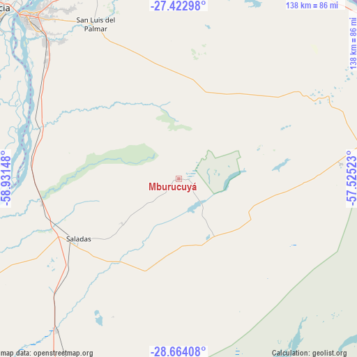
Mburucuyá GPS coordinates[2]
28° 2' 43.152" South, 58° 13' 42.06" West
| Map corner | latitude | longitude |
|---|---|---|
| Upper-left | -27.42298°, | -58.93148° |
| Center: | -28.04532°, | -58.22835° |
| Lower-right: | -28.66408°, | -57.52523° |
| Map W x H: | 138×138 km | = 85.7×85.7mi |
| max Lat: | -21.94467° ⇑25.7% North |
| Mburucuyá: | -28.04532° |
| min Lat: | ⇓74.3% South -54.81084° |
| min Long | Mburucuyá | max Long |
| -72.88605° | -58.22835° | -53.64581° |
| W 87.6%⇐ | ⇒12.4% E |
Elevation
Elevation of Mburucuyá is 79 m = 259 ft, and this is 270.3 m = 887 ft below average elevation for this country.
| Max E: |
4040 m = 13255 ft | 70.4% |
| Avg. | 349.3 m = 1146 ft | |
| Mburucuyá | 79 m = 259 ft | |
Min E: |
-2 m = -7 ft | 29.6% |
See also: Argentina elevation on elevation.city.
Geographical zone
Mburucuyá is located in South temperate zone (between Tropic of Capricorn and the Antarctic Circle). Distance of this Southern Tropic circle is 512.4 km =318.4 mi to North.| Distance of | km | miles | from Mburucuyá |
|---|---|---|---|
| Equator | 3118.3 | 1937.6 | to North |
| Tropic Capricorn | 512.4 | 318.4 | to North |
| Antarctic Circle | 4282.8 | 2661.2 | to South |
| South Pole | 6888.7 | 4280.4 | to South |


Nearby cities:
15 places around Mburucuyá: (largest is in red/bold)
• Concepción
51 km =31.7 mi,  139°
139°
• Empedrado
57.6 km =35.8 mi,  280°
280°
• Herlitzka
53.5 km =33.2 mi,  357°
357°
• Lomas de Vallejos
46 km =28.6 mi,  41°
41°
• Nuestra Señora del Rosario de Caa Catí
68.1 km =42.3 mi,  61°
61°
• Palmar Grande
34.2 km =21.3 mi,  70°
70°
• Ramada Paso
76.2 km =47.3 mi,  354°
354°
• Riachuelo
72.4 km =45 mi,  315°
315°
• Saladas
45.4 km =28.2 mi,  239°
239°
• San Cosme
80 km =49.7 mi,  339°
339°
• San Lorenzo
53.8 km =33.4 mi,  259°
259°
• San Luis del Palmar
67.8 km =42.1 mi,  331°
331°
• San Miguel
62.9 km =39.1 mi,  84°
84°
• San Roque
75.3 km =46.8 mi,  218°
218°
• Santa Rosa
26.5 km =16.5 mi,  156°
156°
Sources, notices
• [Note1] Compared only with cities in Argentina existing in our database
• [Src1] Map data: © OpenStreetMap contributors (CC-BY-SA)
• [Src2] Other city data from geonames.org with taken over terms of usage.
• [Src3] Geographical zone / Annual Mean Temperature by Robert A. Rohde @ Wikipedia
