Villa Las Rosas geodata
Villa Las Rosas (Cordoba) is a populated place; located in Argentina in America/Argentina/Cordoba (GMT-3) time zone. With population of 2,535 people, there are 587 cities with bigger population in this country. Compared to other cities in Argentina, 51.2% of cities are located further ↑North; 73.1% of cities are located further →East and 87% of cities have lower elevation than Villa Las Rosas. Note1


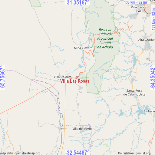
Villa Las Rosas GPS coordinates[2]
31° 57' 0.756" South, 65° 3' 12.744" West
| Map corner | latitude | longitude |
|---|---|---|
| Upper-left | -31.35167°, | -65.75667° |
| Center: | -31.95021°, | -65.05354° |
| Lower-right: | -32.54487°, | -64.35042° |
| Map W x H: | 132.7×132.7 km | = 82.5×82.5mi |
| max Lat: | -21.94467° ⇑51.2% North |
| Villa Las Rosas: | -31.95021° |
| min Lat: | ⇓48.8% South -54.81084° |
| min Long | Villa Las Rosas | max Long |
| -72.88605° | -65.05354° | -53.64581° |
| W 26.9%⇐ | ⇒73.1% E |
Elevation
Elevation of Villa Las Rosas is 744 m = 2441 ft, and this is 394.7 m = 1295 ft above average elevation for this country.
| Max E: |
4040 m = 13255 ft | 13% |
| Villa Las Rosas | 744 m 2441 ft | |
| Avg. | 349.3 m = 1146 ft | |
Min E: |
-2 m = -7 ft | 87% |
See also: Argentina elevation on elevation.city.
Geographical zone
Villa Las Rosas is located in South temperate zone (between Tropic of Capricorn and the Antarctic Circle). Distance of this Southern Tropic circle is 946.6 km =588.2 mi to North.| Distance of | km | miles | from Villa Las Rosas |
|---|---|---|---|
| Equator | 3552.5 | 2207.4 | to North |
| Tropic Capricorn | 946.6 | 588.2 | to North |
| Antarctic Circle | 3848.6 | 2391.4 | to South |
| South Pole | 6454.5 | 4010.6 | to South |


Nearby cities:
15 places around Villa Las Rosas: (largest is in red/bold)
• Alta Gracia
67.7 km =42.1 mi,  60°
60°
• Cuesta Blanca
68.8 km =42.8 mi,  41°
41°
• Embalse
65.1 km =40.5 mi,  113°
113°
• La Cumbrecita
27.1 km =16.8 mi,  77°
77°
• Merlo
43.8 km =27.2 mi,  175°
175°
• Mina Clavero
25.9 km =16.1 mi,  9°
9°
• San Agustín
64.2 km =39.9 mi,  92°
92°
• Santa Rosa de Calamuchita
50.5 km =31.4 mi, 105°
• Santa Rosa del Conlara
45.9 km =28.5 mi,  197°
197°
• Villa Berna
30.6 km =19 mi, 82°
• Villa Cura Brochero
27.4 km =17 mi, 7°
• Villa Dolores
12.8 km =8 mi,  272°
272°
• Villa General Belgrano
47 km =29.2 mi, 93°
• Villa Rumipal
60.1 km =37.3 mi,  116°
116°
• Villa del Dique
61.7 km =38.3 mi, 114°
Sources, notices
• [Note1] Compared only with cities in Argentina existing in our database
• [Src1] Map data: © OpenStreetMap contributors (CC-BY-SA)
• [Src2] Other city data from geonames.org with taken over terms of usage.
• [Src3] Geographical zone / Annual Mean Temperature by Robert A. Rohde @ Wikipedia
