Embalse geodata
Embalse (Cordoba) is a populated place; located in Argentina in America/Argentina/Cordoba (GMT-3) time zone. With population of 15,900 people, there are 213 cities with bigger population in this country. Compared to other cities in Argentina, 53.6% of cities are located further ↑North; 67.1% of cities are located further →East and 80.1% of cities have lower elevation than Embalse. Note1


Embalse GPS coordinates[2]
32° 10' 48" South, 64° 25' 5.124" West
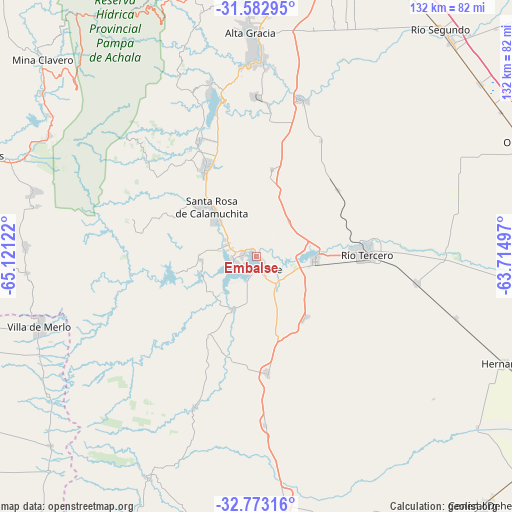
| Map corner | latitude | longitude |
|---|---|---|
| Upper-left | -31.58295°, | -65.12122° |
| Center: | -32.18°, | -64.41809° |
| Lower-right: | -32.77316°, | -63.71497° |
| Map W x H: | 132.3×132.3 km | = 82.2×82.2mi |
| max Lat: | -21.94467° ⇑53.6% North |
| Embalse: | -32.18° |
| min Lat: | ⇓46.4% South -54.81084° |
| min Long | Embalse | max Long |
| -72.88605° | -64.41809° | -53.64581° |
| W 32.9%⇐ | ⇒67.1% E |
Elevation
Elevation of Embalse is 561 m = 1841 ft, and this is 211.7 m = 695 ft above average elevation for this country.
| Max E: |
4040 m = 13255 ft | 19.9% |
| Embalse | 561 m 1841 ft | |
| Avg. | 349.3 m = 1146 ft | |
Min E: |
-2 m = -7 ft | 80.1% |
See also: Argentina elevation on elevation.city.
Geographical zone
Embalse is located in South temperate zone (between Tropic of Capricorn and the Antarctic Circle). Distance of this Southern Tropic circle is 972.2 km =604.1 mi to North.| Distance of | km | miles | from Embalse |
|---|---|---|---|
| Equator | 3578.1 | 2223.3 | to North |
| Tropic Capricorn | 972.2 | 604.1 | to North |
| Antarctic Circle | 3823.1 | 2375.6 | to South |
| South Pole | 6429 | 3994.8 | to South |


Nearby cities:
15 places around Embalse: (largest is in red/bold)
• Almafuerte
15.4 km =9.6 mi,  95°
95°
• Berrotarán
30.3 km =18.8 mi,  174°
174°
• Corralito
27.4 km =17 mi,  50°
50°
• Despeñaderos
42.2 km =26.2 mi,  16°
16°
• Elena
43.6 km =27.1 mi,  177°
177°
• La Cumbrecita
45.8 km =28.5 mi,  313°
313°
• Los Cóndores
20.4 km =12.7 mi,  139°
139°
• Río Tercero
28.6 km =17.8 mi,  88°
88°
• San Agustín
23 km =14.3 mi,  10°
10°
• Santa Rosa de Calamuchita
16.6 km =10.3 mi,  317°
317°
• Tancacha
41.7 km =25.9 mi, 99°
• Villa Berna
41.9 km =26 mi, 314°
• Villa General Belgrano
25.9 km =16.1 mi,  329°
329°
• Villa Rumipal
5.9 km =3.7 mi,  261°
261°
• Villa del Dique
3.5 km =2.2 mi,  276°
276°
Sources, notices
• [Note1] Compared only with cities in Argentina existing in our database
• [Src1] Map data: © OpenStreetMap contributors (CC-BY-SA)
• [Src2] Other city data from geonames.org with taken over terms of usage.
• [Src3] Geographical zone / Annual Mean Temperature by Robert A. Rohde @ Wikipedia
