Merlo geodata
Merlo (San Luis) is a populated place; located in Argentina in America/Argentina/San_Luis (GMT-3) time zone. With population of 11,159 people, there are 270 cities with bigger population in this country. Compared to other cities in Argentina, 55.1% of cities are located further ↑North; 72.6% of cities are located further →East and 89.7% of cities have lower elevation than Merlo. Note1


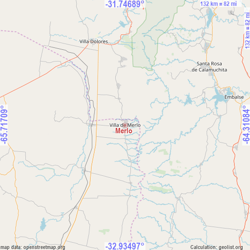
Merlo GPS coordinates[2]
32° 20' 34.368" South, 65° 0' 50.256" West
| Map corner | latitude | longitude |
|---|---|---|
| Upper-left | -31.74689°, | -65.71709° |
| Center: | -32.34288°, | -65.01396° |
| Lower-right: | -32.93497°, | -64.31084° |
| Map W x H: | 132.1×132.1 km | = 82.1×82.1mi |
| max Lat: | -21.94467° ⇑55.1% North |
| Merlo: | -32.34288° |
| min Lat: | ⇓44.9% South -54.81084° |
| min Long | Merlo | max Long |
| -72.88605° | -65.01396° | -53.64581° |
| W 27.4%⇐ | ⇒72.6% E |
Elevation
Elevation of Merlo is 863 m = 2831 ft, and this is 513.7 m = 1685 ft above average elevation for this country.
| Max E: |
4040 m = 13255 ft | 10.3% |
| Merlo | 863 m 2831 ft | |
| Avg. | 349.3 m = 1146 ft | |
Min E: |
-2 m = -7 ft | 89.7% |
See also: Argentina elevation on elevation.city.
Geographical zone
Merlo is located in South temperate zone (between Tropic of Capricorn and the Antarctic Circle). Distance of this Southern Tropic circle is 990.3 km =615.3 mi to North.| Distance of | km | miles | from Merlo |
|---|---|---|---|
| Equator | 3596.2 | 2234.6 | to North |
| Tropic Capricorn | 990.3 | 615.3 | to North |
| Antarctic Circle | 3805 | 2364.3 | to South |
| South Pole | 6410.9 | 3983.5 | to South |


Nearby cities:
15 places around Merlo: (largest is in red/bold)
• Berrotarán
59.9 km =37.2 mi,  101°
101°
• Concarán
32.3 km =20.1 mi,  221°
221°
• Elena
63.4 km =39.4 mi,  113°
113°
• Embalse
58.9 km =36.6 mi,  72°
72°
• La Cumbrecita
54.3 km =33.7 mi,  24°
24°
• Libertador General San Martín
62.6 km =38.9 mi,  263°
263°
• Santa Rosa de Calamuchita
54.3 km =33.7 mi,  55°
55°
• Santa Rosa del Conlara
17.8 km =11.1 mi,  270°
270°
• Tilisarao
50.6 km =31.4 mi,  210°
210°
• Villa Berna
54.5 km =33.9 mi,  29°
29°
• Villa Dolores
47.1 km =29.3 mi,  339°
339°
• Villa General Belgrano
59.2 km =36.8 mi,  46°
46°
• Villa Las Rosas
43.8 km =27.2 mi,  355°
355°
• Villa Rumipal
53.1 km =33 mi, 71°
• Villa del Dique
55.7 km =34.6 mi, 70°
Sources, notices
• [Note1] Compared only with cities in Argentina existing in our database
• [Src1] Map data: © OpenStreetMap contributors (CC-BY-SA)
• [Src2] Other city data from geonames.org with taken over terms of usage.
• [Src3] Geographical zone / Annual Mean Temperature by Robert A. Rohde @ Wikipedia
