Ingeniero Guillermo N. Juárez geodata
Ingeniero Guillermo N. Juárez (Formosa) is a seat of a second-order administrative division; located in Argentina in America/Argentina/Cordoba (GMT-3) time zone. With population of 10,357 people, there are 284 cities with bigger population in this country. Compared to other cities in Argentina, 97.8% of cities are located further ↓South; 56.1% of cities are located further ←West and 56.8% of cities have lower elevation than Ingeniero Guillermo N. Juárez. Note1
Current local time in Ingeniero Guillermo N. Juárez:
11:32 AM, SaturdayDifference from your time zone: hours


Ingeniero Guillermo N. Juárez GPS coordinates[2]
23° 54' 0" South, 61° 51' 0" West
| Map corner | latitude | longitude |
|---|---|---|
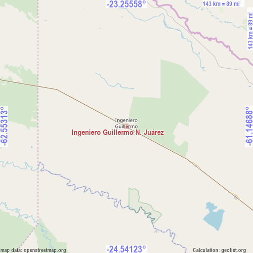
| Upper-left | -23.25558°, | -62.55313° |
| Center: | -23.9°, | -61.85° |
| Lower-right: | -24.54123°, | -61.14688° |
| Map W x H: | 143×143 km | = 88.9×88.9mi |
| max Lat: | -21.94467° ⇑2.2% North |
| Ingeniero Guillermo N. Juárez: | -23.9° |
| min Lat: | ⇓97.8% South -54.81084° |
| min Long | Ingeniero Guill | max Long |
| -72.88605° | -61.85° | -53.64581° |
| W 56.1%⇐ | ⇒43.9% E |
Elevation
Elevation of Ingeniero Guillermo N. Juárez is 185 m = 607 ft, and this is 164.3 m = 539 ft below average elevation for this country.
| Max E: |
4040 m = 13255 ft | 43.2% |
| Avg. | 349.3 m = 1146 ft | |
| Ingeniero Guillermo N. Juárez | 185 m = 607 ft | |
Min E: |
-2 m = -7 ft | 56.8% |
See also: Argentina elevation on elevation.city.
Geographical zone
Ingeniero Guillermo N. Juárez is located in South temperate zone (between Tropic of Capricorn and the Antarctic Circle). Distance of this Southern Tropic circle is 51.5 km =32 mi to North.| Distance of | km | miles | from Ingeniero Guillermo N. Juárez |
|---|---|---|---|
| Equator | 2657.4 | 1651.2 | to North |
| Tropic Capricorn | 51.5 | 32 | to North |
| Antarctic Circle | 4743.7 | 2947.6 | to South |
| South Pole | 7349.6 | 4566.8 | to South |


Nearby cities:
15 places around Ingeniero Guillermo N. Juárez: (largest is in red/bold)
• Apolinario Saravia
225.5 km =140.1 mi,  254°
254°
• Embarcación
241.8 km =150.2 mi,  288°
288°
• Estanislao del Campo
219.4 km =136.3 mi,  125°
125°
• General Enrique Mosconi
88.7 km =55.1 mi,  328°
328°
• General Enrique Mosconi
247.4 km =153.7 mi,  305°
305°
• Ibarreta
248.8 km =154.6 mi, 125°
• Laguna Yema
73 km =45.4 mi,  122°
122°
• Las Lajitas
254.6 km =158.2 mi, 248°
• Las Lomitas
156 km =96.9 mi, 125°
• Monte Quemado
233.8 km =145.3 mi,  205°
205°
• Palma Sola
249.4 km =155 mi,  268°
268°
• Pozo del Tigre
190.2 km =118.2 mi, 125°
• Rivadavia
109.8 km =68.2 mi, 253°
• Taco Pozo
238.4 km =148.1 mi,  216°
216°
• Tartagal
251.9 km =156.5 mi, 307°
Sources, notices
• [Note1] Compared only with cities in Argentina existing in our database
• [Src1] Map data: © OpenStreetMap contributors (CC-BY-SA)
• [Src2] Other city data from geonames.org with taken over terms of usage.
• [Src3] Geographical zone / Annual Mean Temperature by Robert A. Rohde @ Wikipedia
