El Bolsón geodata
El Bolsón (Rio Negro) is a populated place; located in Argentina in America/Argentina/Salta (GMT-3) time zone. With population of 15,537 people, there are 218 cities with bigger population in this country. Compared to other cities in Argentina, 95.6% of cities are located further ↑North; 99.2% of cities are located further →East and 68.3% of cities have lower elevation than El Bolsón. Note1


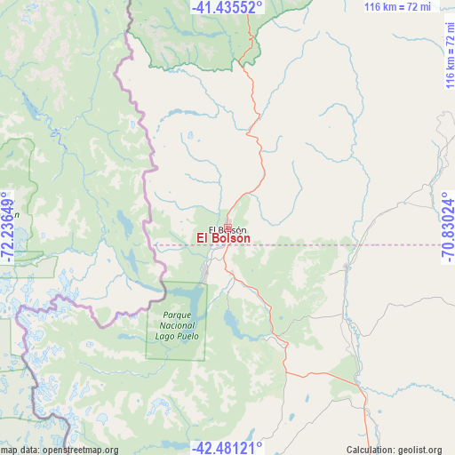
El Bolsón GPS coordinates[2]
41° 57' 37.836" South, 71° 32' 0.096" West
| Map corner | latitude | longitude |
|---|---|---|
| Upper-left | -41.43552°, | -72.23649° |
| Center: | -41.96051°, | -71.53336° |
| Lower-right: | -42.48121°, | -70.83024° |
| Map W x H: | 116.3×116.3 km | = 72.3×72.3mi |
| max Lat: | -21.94467° ⇑95.6% North |
| El Bolsón: | -41.96051° |
| min Lat: | ⇓4.4% South -54.81084° |
| min Long | El Bolsón | max Long |
| -72.88605° | -71.53336° | -53.64581° |
| W 0.8%⇐ | ⇒99.2% E |
Elevation
Elevation of El Bolsón is 320 m = 1050 ft, and this is 29.3 m = 96 ft below average elevation for this country.
| Max E: |
4040 m = 13255 ft | 31.7% |
| Avg. | 349.3 m = 1146 ft | |
| El Bolsón | 320 m = 1050 ft | |
Min E: |
-2 m = -7 ft | 68.3% |
See also: Argentina elevation on elevation.city.
Geographical zone
El Bolsón is located in South temperate zone (between Tropic of Capricorn and the Antarctic Circle). Distance of this Southern Tropic circle is 2059.7 km =1279.8 mi to North.| Distance of | km | miles | from El Bolsón |
|---|---|---|---|
| Equator | 4665.6 | 2899.1 | to North |
| Tropic Capricorn | 2059.7 | 1279.8 | to North |
| Antarctic Circle | 2735.6 | 1699.8 | to South |
| South Pole | 5341.5 | 3319.1 | to South |


Nearby cities:
15 places around El Bolsón: (largest is in red/bold)
• Comallo
147.7 km =91.8 mi,  45°
45°
• El Maitén
31.8 km =19.8 mi,  108°
108°
• Esquel
107.2 km =66.6 mi,  170°
170°
• Gastre
193.6 km =120.3 mi,  99°
99°
• Hoyo de Epuyén
12.6 km =7.8 mi, 170°
• Ingeniero Jacobacci
179.1 km =111.3 mi,  66°
66°
• Lago Puelo
13.2 km =8.2 mi,  206°
206°
• Leleque
63.2 km =39.3 mi,  142°
142°
• Pilcaniyeu
115.1 km =71.5 mi,  35°
35°
• San Carlos de Bariloche
92.5 km =57.5 mi,  11°
11°
• San Martín de los Andes
201 km =124.9 mi,  4°
4°
• Tecka
180.5 km =112.2 mi,  160°
160°
• Trevelin
125.3 km =77.9 mi,  177°
177°
• Villa La Angostura
133.6 km =83 mi,  355°
355°
• Ñorquinco
53.7 km =33.4 mi,  76°
76°
Sources, notices
• [Note1] Compared only with cities in Argentina existing in our database
• [Src1] Map data: © OpenStreetMap contributors (CC-BY-SA)
• [Src2] Other city data from geonames.org with taken over terms of usage.
• [Src3] Geographical zone / Annual Mean Temperature by Robert A. Rohde @ Wikipedia
