Crespo geodata
Crespo (Entre Rios) is a populated place; located in Argentina in America/Argentina/Cordoba (GMT-3) time zone. With population of 18,296 people, there are 202 cities with bigger population in this country. Compared to other cities in Argentina, 52.1% of cities are located further ↑North; 65.8% of cities are located further ←West and 59.8% of cities have higher elevation than Crespo. Note1


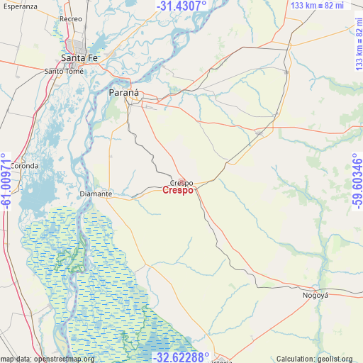
Crespo GPS coordinates[2]
32° 1' 43.428" South, 60° 18' 23.688" West
| Map corner | latitude | longitude |
|---|---|---|
| Upper-left | -31.4307°, | -61.00971° |
| Center: | -32.02873°, | -60.30658° |
| Lower-right: | -32.62288°, | -59.60346° |
| Map W x H: | 132.6×132.6 km | = 82.4×82.4mi |
| max Lat: | -21.94467° ⇑52.1% North |
| Crespo: | -32.02873° |
| min Lat: | ⇓47.9% South -54.81084° |
| min Long | Crespo | max Long |
| -72.88605° | -60.30658° | -53.64581° |
| W 65.8%⇐ | ⇒34.2% E |
Elevation
Elevation of Crespo is 109 m = 358 ft, and this is 240.3 m = 788 ft below average elevation for this country.
| Max E: |
4040 m = 13255 ft | 59.8% |
| Avg. | 349.3 m = 1146 ft | |
| Crespo | 109 m = 358 ft | |
Min E: |
-2 m = -7 ft | 40.2% |
See also: Argentina elevation on elevation.city.
Geographical zone
Crespo is located in South temperate zone (between Tropic of Capricorn and the Antarctic Circle). Distance of this Southern Tropic circle is 955.3 km =593.6 mi to North.| Distance of | km | miles | from Crespo |
|---|---|---|---|
| Equator | 3561.3 | 2212.9 | to North |
| Tropic Capricorn | 955.3 | 593.6 | to North |
| Antarctic Circle | 3839.9 | 2386 | to South |
| South Pole | 6445.8 | 4005.2 | to South |


Nearby cities:
15 places around Crespo: (largest is in red/bold)
• Aranguren
27.4 km =17 mi,  150°
150°
• Coronda
58.2 km =36.2 mi,  276°
276°
• Diamante
31.5 km =19.6 mi,  262°
262°
• General Ramírez
19.2 km =11.9 mi, 148°
• Hernández
43.5 km =27 mi,  141°
141°
• Oro Verde
30.1 km =18.7 mi,  318°
318°
• Paraná
39 km =24.2 mi,  327°
327°
• San Benito
30.1 km =18.7 mi, 334°
• Santa Fe
56.8 km =35.3 mi, 318°
• Santo Tomé
59.4 km =36.9 mi,  313°
313°
• Seguí
18.9 km =11.7 mi,  64°
64°
• Tabossi
43.3 km =26.9 mi,  54°
54°
• Viale
33.4 km =20.8 mi, 57°
• Villa María Grande
55.6 km =34.5 mi,  43°
43°
• Villa Urquiza
42.9 km =26.7 mi,  351°
351°
Sources, notices
• [Note1] Compared only with cities in Argentina existing in our database
• [Src1] Map data: © OpenStreetMap contributors (CC-BY-SA)
• [Src2] Other city data from geonames.org with taken over terms of usage.
• [Src3] Geographical zone / Annual Mean Temperature by Robert A. Rohde @ Wikipedia
