San Blas de los Sauces geodata
San Blas de los Sauces (La Rioja) is a seat of a second-order administrative division; located in Argentina in America/Argentina/La_Rioja (GMT-3) time zone. In our database, there are 785 cities with bigger population. Compared to other cities in Argentina, 72% of cities are located further ↓South; 86.4% of cities are located further →East and 92.6% of cities have lower elevation than San Blas de los Sauces. Note1
Current local time in San Blas de los Sauces:
05:23 AM, SaturdayDifference from your time zone: hours


San Blas de los Sauces GPS coordinates[2]
28° 24' 37.836" South, 67° 5' 36.276" West
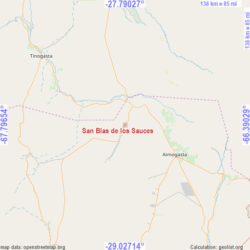
| Map corner | latitude | longitude |
|---|---|---|
| Upper-left | -27.79027°, | -67.79654° |
| Center: | -28.41051°, | -67.09341° |
| Lower-right: | -29.02714°, | -66.39029° |
| Map W x H: | 137.5×137.5 km | = 85.4×85.4mi |
| max Lat: | -21.94467° ⇑28% North |
| San Blas de los Sauces: | -28.41051° |
| min Lat: | ⇓72% South -54.81084° |
| min Long | San Blas de los | max Long |
| -72.88605° | -67.09341° | -53.64581° |
| W 13.6%⇐ | ⇒86.4% E |
Elevation
Elevation of San Blas de los Sauces is 1022 m = 3353 ft, and this is 672.7 m = 2207 ft above average elevation for this country.
| Max E: |
4040 m = 13255 ft | 7.4% |
| San Blas de los Sauces | 1022 m 3353 ft | |
| Avg. | 349.3 m = 1146 ft | |
Min E: |
-2 m = -7 ft | 92.6% |
See also: Argentina elevation on elevation.city.
Geographical zone
San Blas de los Sauces is located in South temperate zone (between Tropic of Capricorn and the Antarctic Circle). Distance of this Southern Tropic circle is 553 km =343.6 mi to North.| Distance of | km | miles | from San Blas de los Sauces |
|---|---|---|---|
| Equator | 3159 | 1962.9 | to North |
| Tropic Capricorn | 553 | 343.6 | to North |
| Antarctic Circle | 4242.2 | 2636 | to South |
| South Pole | 6848.1 | 4255.2 | to South |


Nearby cities:
15 places around San Blas de los Sauces: (largest is in red/bold)
• Aimogasta
32.7 km =20.3 mi,  120°
120°
• Aminga
51.2 km =31.8 mi,  161°
161°
• Arauco
35 km =21.7 mi, 122°
• Belén
84.7 km =52.6 mi,  4°
4°
• Chilecito
92.4 km =57.4 mi,  205°
205°
• Chumbicha
97.2 km =60.4 mi, 120°
• Famatina
70.5 km =43.8 mi,  216°
216°
• Fiambalá
96.9 km =60.2 mi,  327°
327°
• La Puerta de San José
96 km =59.7 mi, 4°
• Londres
77.5 km =48.2 mi,  357°
357°
• Mutquín
93.6 km =58.2 mi,  83°
83°
• Pomán
85.4 km =53.1 mi,  88°
88°
• Saujil
90.2 km =56 mi,  73°
73°
• Sañogasta
76.2 km =47.3 mi,  181°
181°
• Tinogasta
60.2 km =37.4 mi,  309°
309°
Sources, notices
• [Note1] Compared only with cities in Argentina existing in our database
• [Src1] Map data: © OpenStreetMap contributors (CC-BY-SA)
• [Src2] Other city data from geonames.org with taken over terms of usage.
• [Src3] Geographical zone / Annual Mean Temperature by Robert A. Rohde @ Wikipedia
