Tinogasta geodata
Tinogasta (Catamarca) is a seat of a second-order administrative division; located in Argentina in America/Argentina/Catamarca (GMT-3) time zone. With population of 14,509 people, there are 233 cities with bigger population in this country. Compared to other cities in Argentina, 73.8% of cities are located further ↓South; 88.2% of cities are located further →East and 94.9% of cities have lower elevation than Tinogasta. Note1


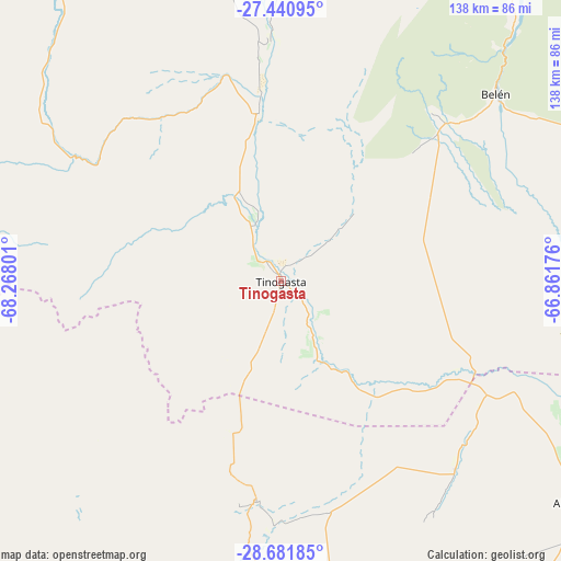
Tinogasta GPS coordinates[2]
28° 3' 47.484" South, 67° 33' 53.568" West
| Map corner | latitude | longitude |
|---|---|---|
| Upper-left | -27.44095°, | -68.26801° |
| Center: | -28.06319°, | -67.56488° |
| Lower-right: | -28.68185°, | -66.86176° |
| Map W x H: | 138×138 km | = 85.7×85.7mi |
| max Lat: | -21.94467° ⇑26.2% North |
| Tinogasta: | -28.06319° |
| min Lat: | ⇓73.8% South -54.81084° |
| min Long | Tinogasta | max Long |
| -72.88605° | -67.56488° | -53.64581° |
| W 11.8%⇐ | ⇒88.2% E |
Elevation
Elevation of Tinogasta is 1212 m = 3976 ft, and this is 862.7 m = 2830 ft above average elevation for this country.
| Max E: |
4040 m = 13255 ft | 5.1% |
| Tinogasta | 1212 m 3976 ft | |
| Avg. | 349.3 m = 1146 ft | |
Min E: |
-2 m = -7 ft | 94.9% |
See also: Argentina elevation on elevation.city.
Geographical zone
Tinogasta is located in South temperate zone (between Tropic of Capricorn and the Antarctic Circle). Distance of this Southern Tropic circle is 514.4 km =319.6 mi to North.| Distance of | km | miles | from Tinogasta |
|---|---|---|---|
| Equator | 3120.3 | 1938.9 | to North |
| Tropic Capricorn | 514.4 | 319.6 | to North |
| Antarctic Circle | 4280.8 | 2660 | to South |
| South Pole | 6886.7 | 4279.2 | to South |


Nearby cities:
15 places around Tinogasta: (largest is in red/bold)
• Aimogasta
92.6 km =57.5 mi,  126°
126°
• Aminga
107 km =66.5 mi,  144°
144°
• Arauco
95 km =59 mi, 127°
• Belén
69.8 km =43.4 mi,  48°
48°
• Chilecito
122.3 km =76 mi,  176°
176°
• Famatina
95.7 km =59.5 mi, 177°
• Fiambalá
43.8 km =27.2 mi,  353°
353°
• Hualfín
117.6 km =73.1 mi,  37°
37°
• La Puerta de San José
78.5 km =48.8 mi, 43°
• Londres
57.5 km =35.7 mi, 47°
• Puerta de Corral Quemado
111.4 km =69.2 mi,  33°
33°
• San Blas de los Sauces
60.2 km =37.4 mi, 129°
• Sañogasta
122.8 km =76.3 mi,  159°
159°
• Villa Castelli
123.8 km =76.9 mi,  211°
211°
• Vinchina
99.7 km =62 mi,  219°
219°
Sources, notices
• [Note1] Compared only with cities in Argentina existing in our database
• [Src1] Map data: © OpenStreetMap contributors (CC-BY-SA)
• [Src2] Other city data from geonames.org with taken over terms of usage.
• [Src3] Geographical zone / Annual Mean Temperature by Robert A. Rohde @ Wikipedia
