Antofagasta de la Sierra geodata
Antofagasta de la Sierra (Catamarca) is a seat of a second-order administrative division; located in Argentina in America/Argentina/Catamarca (GMT-3) time zone. With population of 500 people, there are 783 cities with bigger population in this country. Compared to other cities in Argentina, 92.2% of cities are located further ↓South; 87.4% of cities are located further →East and 99.3% of cities have lower elevation than Antofagasta de la Sierra. Note1
Current local time in Antofagasta de la Sierra:
05:21 AM, SaturdayDifference from your time zone: hours


Antofagasta de la Sierra GPS coordinates[2]
26° 3' 33.84" South, 67° 24' 22.896" West
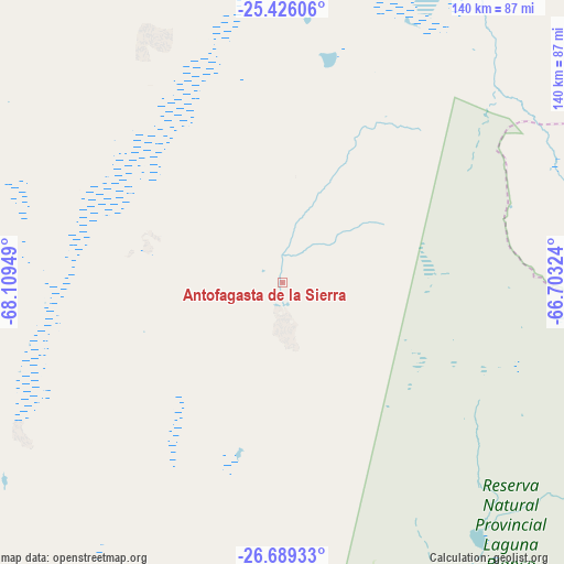
| Map corner | latitude | longitude |
|---|---|---|
| Upper-left | -25.42606°, | -68.10949° |
| Center: | -26.0594°, | -67.40636° |
| Lower-right: | -26.68933°, | -66.70324° |
| Map W x H: | 140.5×140.5 km | = 87.3×87.3mi |
| max Lat: | -21.94467° ⇑7.8% North |
| Antofagasta de la Sierra: | -26.0594° |
| min Lat: | ⇓92.2% South -54.81084° |
| min Long | Antofagasta de | max Long |
| -72.88605° | -67.40636° | -53.64581° |
| W 12.6%⇐ | ⇒87.4% E |
Elevation
Elevation of Antofagasta de la Sierra is 3368 m = 11050 ft, and this is 3018.7 m = 9904 ft above average elevation for this country.
| Max E: |
4040 m = 13255 ft | 0.7% |
| Antofagasta de la Sierra | 3368 m 11050 ft | |
| Avg. | 349.3 m = 1146 ft | |
Min E: |
-2 m = -7 ft | 99.3% |
See also: Argentina elevation on elevation.city.
Geographical zone
Antofagasta de la Sierra is located in South temperate zone (between Tropic of Capricorn and the Antarctic Circle). Distance of this Southern Tropic circle is 291.6 km =181.2 mi to North.| Distance of | km | miles | from Antofagasta de la Sierra |
|---|---|---|---|
| Equator | 2897.5 | 1800.4 | to North |
| Tropic Capricorn | 291.6 | 181.2 | to North |
| Antarctic Circle | 4503.6 | 2798.4 | to South |
| South Pole | 7109.5 | 4417.6 | to South |


Nearby cities:
15 places around Antofagasta de la Sierra: (largest is in red/bold)
• Belén
180.9 km =112.4 mi,  168°
168°
• Cachí
162.5 km =101 mi,  50°
50°
• Cafayate
142.7 km =88.7 mi,  90°
90°
• Fiambalá
180.6 km =112.2 mi,  186°
186°
• Guachipas
199.1 km =123.7 mi,  72°
72°
• Hualfín
142 km =88.2 mi,  156°
156°
• La Poma
191.8 km =119.2 mi,  39°
39°
• La Puerta de San José
170.2 km =105.8 mi, 166°
• La Viña
195.7 km =121.6 mi, 70°
• Londres
186 km =115.6 mi, 171°
• Molinos
131 km =81.4 mi,  58°
58°
• Puerta de Corral Quemado
138.3 km =85.9 mi, 160°
• San Carlos
148.9 km =92.5 mi,  82°
82°
• Santa María
152.7 km =94.9 mi,  117°
117°
• Tafí del Valle
190.5 km =118.4 mi, 117°
Sources, notices
• [Note1] Compared only with cities in Argentina existing in our database
• [Src1] Map data: © OpenStreetMap contributors (CC-BY-SA)
• [Src2] Other city data from geonames.org with taken over terms of usage.
• [Src3] Geographical zone / Annual Mean Temperature by Robert A. Rohde @ Wikipedia
