Alderetes geodata
Alderetes (Tucuman) is a populated place; located in Argentina in America/Argentina/Tucuman (GMT-3) time zone. With population of 38,466 people, there are 111 cities with bigger population in this country. Compared to other cities in Argentina, 88% of cities are located further ↓South; 73.7% of cities are located further →East and 75.4% of cities have lower elevation than Alderetes. Note1


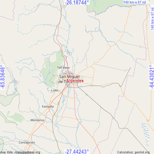
Alderetes GPS coordinates[2]
26° 49' 0.012" South, 65° 7' 59.988" West
| Map corner | latitude | longitude |
|---|---|---|
| Upper-left | -26.18744°, | -65.83646° |
| Center: | -26.81667°, | -65.13333° |
| Lower-right: | -27.44243°, | -64.43021° |
| Map W x H: | 139.5×139.5 km | = 86.7×86.7mi |
| max Lat: | -21.94467° ⇑12% North |
| Alderetes: | -26.81667° |
| min Lat: | ⇓88% South -54.81084° |
| min Long | Alderetes | max Long |
| -72.88605° | -65.13333° | -53.64581° |
| W 26.3%⇐ | ⇒73.7% E |
Elevation
Elevation of Alderetes is 454 m = 1490 ft, and this is 104.7 m = 344 ft above average elevation for this country.
| Max E: |
4040 m = 13255 ft | 24.6% |
| Alderetes | 454 m 1490 ft | |
| Avg. | 349.3 m = 1146 ft | |
Min E: |
-2 m = -7 ft | 75.4% |
See also: Argentina elevation on elevation.city.
Geographical zone
Alderetes is located in South temperate zone (between Tropic of Capricorn and the Antarctic Circle). Distance of this Southern Tropic circle is 375.8 km =233.5 mi to North.| Distance of | km | miles | from Alderetes |
|---|---|---|---|
| Equator | 2981.7 | 1852.7 | to North |
| Tropic Capricorn | 375.8 | 233.5 | to North |
| Antarctic Circle | 4419.4 | 2746.1 | to South |
| South Pole | 7025.3 | 4365.3 | to South |


Nearby cities:
15 places around Alderetes: (largest is in red/bold)
• Banda del Río Salí
3.8 km =2.4 mi,  240°
240°
• Bella Vista
29.4 km =18.3 mi,  214°
214°
• Burruyacú
52.5 km =32.6 mi,  47°
47°
• Concepción
74.2 km =46.1 mi,  218°
218°
• Famaillá
37.6 km =23.4 mi,  225°
225°
• La Candelaria
77.1 km =47.9 mi,  6°
6°
• Monteros
53.2 km =33.1 mi, 222°
• Pozo Hondo
74.6 km =46.4 mi,  121°
121°
• San Isidro de Lules
23.8 km =14.8 mi, 238°
• San Miguel de Tucumán
8.9 km =5.5 mi,  264°
264°
• Simoca
54.3 km =33.7 mi,  204°
204°
• Tafí Viejo
15.6 km =9.7 mi,  306°
306°
• Tafí del Valle
57.3 km =35.6 mi,  265°
265°
• Trancas
66.7 km =41.4 mi,  347°
347°
• Yerba Buena
18.2 km =11.3 mi, 270°
Sources, notices
• [Note1] Compared only with cities in Argentina existing in our database
• [Src1] Map data: © OpenStreetMap contributors (CC-BY-SA)
• [Src2] Other city data from geonames.org with taken over terms of usage.
• [Src3] Geographical zone / Annual Mean Temperature by Robert A. Rohde @ Wikipedia
