Nikelsdorf geodata
Nikelsdorf (Carinthia) is a populated place; located in Austria in Europe/Vienna (GMT+2) time zone. With population of 572 people, there are 2240 cities with bigger population in this country. Compared to other cities in Austria, 95.1% of cities are located further ↑North; 72.6% of cities are located further →East and 64.5% of cities have lower elevation than Nikelsdorf. Note1
Administrative division(s):
- Level 1: Carinthia
- Level 2: Politischer Bezirk Villach Land
- Level 3: Paternion


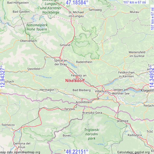
Nikelsdorf GPS coordinates[2]
46° 42' 20.988" North, 13° 38' 47.004" East
| Map corner | latitude | longitude |
|---|---|---|
| Upper-left | 47.18584°, | 12.94327° |
| Center: | 46.70583°, | 13.64639° |
| Lower-right: | 46.22151°, | 14.34952° |
| Map W x H: | 107.2×107.2 km | = 66.6×66.6mi |
| max Lat: | 48.98333° ⇑95.1% North |
| Nikelsdorf: | 46.70583° |
| min Lat: | ⇓4.9% South 46.48841° |
| min Long | Nikelsdorf | max Long |
| 9.57802° | 13.64639° | 17.1° |
| W 27.4%⇐ | ⇒72.6% E |
Elevation
Elevation of Nikelsdorf is 549 m = 1801 ft, and this is 43.5 m = 143 ft above average elevation for this country.
| Max E: |
2140 m = 7021 ft | 35.5% |
| Nikelsdorf | 549 m 1801 ft | |
| Avg. | 505.5 m = 1658 ft | |
Min E: |
118 m = 387 ft | 64.5% |
See also: Austria elevation on elevation.city.
Geographical zone
Nikelsdorf is located in North temperate zone (between Tropic of Cancer and the Arctic Circle). Distance of this North polar circle is 2208 km =1372 mi to North.| Distance of | km | miles | from Nikelsdorf |
|---|---|---|---|
| North Pole | 4813.9 | 2991.2 | to North |
| Arctic Circle | 2208 | 1372 | to North |
| Tropic Cancer | 2587.3 | 1607.7 | to South |
| Equator | 5193.2 | 3226.9 | to South |


Nearby cities:
15 places around Nikelsdorf: (largest is in red/bold)
• Bleiberg-Kreuth
8.3 km =5.2 mi,  185°
185°
• Döbriach
8.3 km =5.2 mi,  5°
5°
• Feistritz an der Drau
1.5 km =0.9 mi,  108°
108°
• Feld am See
11 km =6.8 mi,  44°
44°
• Ferndorf
3.7 km =2.3 mi,  336°
336°
• Fresach
3.6 km =2.2 mi,  72°
72°
• Millstatt
12 km =7.5 mi, 335°
• Neu-Feffernitz
3.2 km =2 mi,  128°
128°
• Nötsch bei Bleiberg
9 km =5.6 mi,  179°
179°
• Paternion
1.2 km =0.7 mi,  319°
319°
• Puch
9.7 km =6 mi,  116°
116°
• Radenthein
11.6 km =7.2 mi,  25°
25°
• Stockenboi
9.7 km =6 mi,  283°
283°
• Untertweng
11.6 km =7.2 mi, 36°
• Weissenstein
6.8 km =4.2 mi, 109°
Sources, notices
• [Note1] Compared only with cities in Austria existing in our database
• [Src1] Map data: © OpenStreetMap contributors (CC-BY-SA)
• [Src2] Other city data from geonames.org with taken over terms of usage.
• [Src3] Geographical zone / Annual Mean Temperature by Robert A. Rohde @ Wikipedia
