Reitberg geodata
Reitberg (Salzburg) is a populated place; located in Austria in Europe/Vienna (GMT+2) time zone. With population of 1,156 people, there are 1095 cities with bigger population in this country. Compared to other cities in Austria, 59% of cities are located further ↓South; 79.9% of cities are located further →East and 72.7% of cities have lower elevation than Reitberg. Note1
Administrative division(s):
- Level 1: Salzburg
- Level 2: Politischer Bezirk Salzburg-Umgebung
- Level 3: Eugendorf


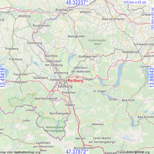
Reitberg GPS coordinates[2]
47° 51' 9.684" North, 13° 9' 26.28" East
| Map corner | latitude | longitude |
|---|---|---|
| Upper-left | 48.32237°, | 12.45418° |
| Center: | 47.85269°, | 13.1573° |
| Lower-right: | 47.37872°, | 13.86043° |
| Map W x H: | 104.9×104.9 km | = 65.2×65.2mi |
| max Lat: | 48.98333° ⇑41% North |
| Reitberg: | 47.85269° |
| min Lat: | ⇓59% South 46.48841° |
| min Long | Reitberg | max Long |
| 9.57802° | 13.1573° | 17.1° |
| W 20.1%⇐ | ⇒79.9% E |
Elevation
Elevation of Reitberg is 622 m = 2041 ft, and this is 116.5 m = 382 ft above average elevation for this country.
| Max E: |
2140 m = 7021 ft | 27.3% |
| Reitberg | 622 m 2041 ft | |
| Avg. | 505.5 m = 1658 ft | |
Min E: |
118 m = 387 ft | 72.7% |
See also: Austria elevation on elevation.city.
Geographical zone
Reitberg is located in North temperate zone (between Tropic of Cancer and the Arctic Circle). Distance of this North polar circle is 2080.5 km =1292.8 mi to North.| Distance of | km | miles | from Reitberg |
|---|---|---|---|
| North Pole | 4686.3 | 2911.9 | to North |
| Arctic Circle | 2080.5 | 1292.8 | to North |
| Tropic Cancer | 2714.8 | 1686.9 | to South |
| Equator | 5320.7 | 3306.1 | to South |


Nearby cities:
15 places around Reitberg: (largest is in red/bold)
• Brunn
4.5 km =2.8 mi,  338°
338°
• Enzersberg
3.2 km =2 mi,  95°
95°
• Esch
5 km =3.1 mi,  254°
254°
• Eugenbach
2.5 km =1.6 mi,  313°
313°
• Eugendorf
2.9 km =1.8 mi, 305°
• Habach
3.9 km =2.4 mi,  174°
174°
• Hallwang
5.5 km =3.4 mi,  266°
266°
• Henndorf am Wallersee
5.6 km =3.5 mi,  20°
20°
• Koppl
5 km =3.1 mi,  181°
181°
• Plainfeld
2.9 km =1.8 mi,  137°
137°
• Schwaighofen
2.8 km =1.7 mi,  212°
212°
• Seewalchen
5.6 km =3.5 mi, 341°
• Unterdorf
5.3 km =3.3 mi, 99°
• Wimmsiedlung
4.8 km =3 mi,  327°
327°
• Zilling
4.3 km =2.7 mi, 265°
Sources, notices
• [Note1] Compared only with cities in Austria existing in our database
• [Src1] Map data: © OpenStreetMap contributors (CC-BY-SA)
• [Src2] Other city data from geonames.org with taken over terms of usage.
• [Src3] Geographical zone / Annual Mean Temperature by Robert A. Rohde @ Wikipedia
