Wolfpassing geodata
Wolfpassing (Lower Austria) is a seat of a third-order administrative division; located in Austria in Europe/Vienna (GMT+2) time zone. With population of 493 people, there are 2516 cities with bigger population in this country. Compared to other cities in Austria, 71.2% of cities are located further ↓South; 55.1% of cities are located further ←West and 75.8% of cities have higher elevation than Wolfpassing. Note1
Administrative division(s):
- Level 1: Lower Austria
- Level 2: Politischer Bezirk Scheibbs
- Level 3: Wolfpassing


Wolfpassing GPS coordinates[2]
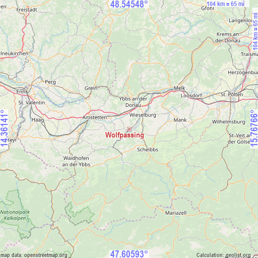
48° 4' 40.26" North, 15° 3' 52.308" East
| Map corner | latitude | longitude |
|---|---|---|
| Upper-left | 48.54548°, | 14.36141° |
| Center: | 48.07785°, | 15.06453° |
| Lower-right: | 47.60593°, | 15.76766° |
| Map W x H: | 104.5×104.5 km | = 64.9×64.9mi |
| max Lat: | 48.98333° ⇑28.8% North |
| Wolfpassing: | 48.07785° |
| min Lat: | ⇓71.2% South 46.48841° |
| min Long | Wolfpassing | max Long |
| 9.57802° | 15.06453° | 17.1° |
| W 55.1%⇐ | ⇒44.9% E |
Elevation
Elevation of Wolfpassing is 298 m = 978 ft, and this is 207.5 m = 681 ft below average elevation for this country.
| Max E: |
2140 m = 7021 ft | 75.8% |
| Avg. | 505.5 m = 1658 ft | |
| Wolfpassing | 298 m = 978 ft | |
Min E: |
118 m = 387 ft | 24.2% |
See also: Austria elevation on elevation.city.
Geographical zone
Wolfpassing is located in North temperate zone (between Tropic of Cancer and the Arctic Circle). Distance of this North polar circle is 2055.4 km =1277.2 mi to North.| Distance of | km | miles | from Wolfpassing |
|---|---|---|---|
| North Pole | 4661.3 | 2896.4 | to North |
| Arctic Circle | 2055.4 | 1277.2 | to North |
| Tropic Cancer | 2739.8 | 1702.4 | to South |
| Equator | 5345.8 | 3321.7 | to South |


Nearby cities:
15 places around Wolfpassing: (largest is in red/bold)
• Blindenmarkt
8 km =5 mi,  313°
313°
• Euratsfeld
9.9 km =6.2 mi,  272°
272°
• Ferschnitz
6.2 km =3.9 mi,  287°
287°
• Göttsbach
9.9 km =6.2 mi,  0°
0°
• Höfling
3.3 km =2.1 mi,  218°
218°
• Mühling
5.7 km =3.5 mi,  62°
62°
• Neumarkt an der Ybbs
7 km =4.3 mi,  355°
355°
• Purgstall
5.6 km =3.5 mi,  112°
112°
• Randegg
10 km =6.2 mi, 222°
• Steinakirchen am Forst
1.5 km =0.9 mi,  233°
233°
• Unteramt
9.1 km =5.7 mi,  192°
192°
• Wang
4.6 km =2.9 mi, 217°
• Weinzierl
7.2 km =4.5 mi,  39°
39°
• Wieselburg
8 km =5 mi, 39°
• Ybbs an der Donau
10 km =6.2 mi,  8°
8°
Sources, notices
• [Note1] Compared only with cities in Austria existing in our database
• [Src1] Map data: © OpenStreetMap contributors (CC-BY-SA)
• [Src2] Other city data from geonames.org with taken over terms of usage.
• [Src3] Geographical zone / Annual Mean Temperature by Robert A. Rohde @ Wikipedia
