Weinzierl geodata
Weinzierl (Lower Austria) is a populated place; located in Austria in Europe/Vienna (GMT+2) time zone. With population of 873 people, there are 1479 cities with bigger population in this country. Compared to other cities in Austria, 74.1% of cities are located further ↓South; 56.4% of cities are located further ←West and 83% of cities have higher elevation than Weinzierl. Note1
Administrative division(s):
- Level 1: Lower Austria
- Level 2: Politischer Bezirk Scheibbs
- Level 3: Wieselburg-Land


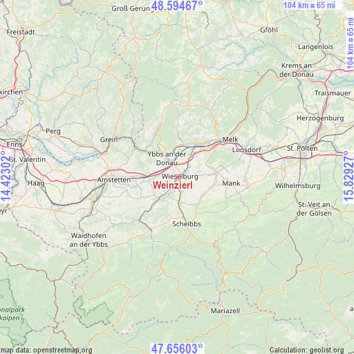
Weinzierl GPS coordinates[2]
48° 7' 38.964" North, 15° 7' 34.104" East
| Map corner | latitude | longitude |
|---|---|---|
| Upper-left | 48.59467°, | 14.42302° |
| Center: | 48.12749°, | 15.12614° |
| Lower-right: | 47.65603°, | 15.82927° |
| Map W x H: | 104.4×104.4 km | = 64.9×64.9mi |
| max Lat: | 48.98333° ⇑25.9% North |
| Weinzierl: | 48.12749° |
| min Lat: | ⇓74.1% South 46.48841° |
| min Long | Weinzierl | max Long |
| 9.57802° | 15.12614° | 17.1° |
| W 56.4%⇐ | ⇒43.6% E |
Elevation
Elevation of Weinzierl is 258 m = 846 ft, and this is 247.5 m = 812 ft below average elevation for this country.
| Max E: |
2140 m = 7021 ft | 83% |
| Avg. | 505.5 m = 1658 ft | |
| Weinzierl | 258 m = 846 ft | |
Min E: |
118 m = 387 ft | 17% |
See also: Austria elevation on elevation.city.
Geographical zone
Weinzierl is located in North temperate zone (between Tropic of Cancer and the Arctic Circle). Distance of this North polar circle is 2049.9 km =1273.7 mi to North.| Distance of | km | miles | from Weinzierl |
|---|---|---|---|
| North Pole | 4655.8 | 2893 | to North |
| Arctic Circle | 2049.9 | 1273.7 | to North |
| Tropic Cancer | 2745.4 | 1705.9 | to South |
| Equator | 5351.3 | 3325.1 | to South |


Nearby cities:
15 places around Weinzierl: (largest is in red/bold)
• Bergland
5.4 km =3.4 mi,  54°
54°
• Erlauf
7.5 km =4.7 mi,  34°
34°
• Gottsdorf
7 km =4.3 mi,  349°
349°
• Göttsbach
6.2 km =3.9 mi,  314°
314°
• Hofamt Priel
8.4 km =5.2 mi,  334°
334°
• Mühling
2.9 km =1.8 mi,  171°
171°
• Neumarkt an der Ybbs
5.3 km =3.3 mi,  286°
286°
• Persenbeug
7.2 km =4.5 mi,  337°
337°
• Petzenkirchen
3 km =1.9 mi,  44°
44°
• Purgstall
7.7 km =4.8 mi,  175°
175°
• Sankt Martin am Ybbsfelde
8.8 km =5.5 mi,  297°
297°
• Steinakirchen am Forst
8.7 km =5.4 mi,  222°
222°
• Wieselburg
0.8 km =0.5 mi, 39°
• Wolfpassing
7.2 km =4.5 mi, 219°
• Ybbs an der Donau
5.4 km =3.4 mi,  323°
323°
Sources, notices
• [Note1] Compared only with cities in Austria existing in our database
• [Src1] Map data: © OpenStreetMap contributors (CC-BY-SA)
• [Src2] Other city data from geonames.org with taken over terms of usage.
• [Src3] Geographical zone / Annual Mean Temperature by Robert A. Rohde @ Wikipedia
