Mühling geodata
Mühling (Lower Austria) is a populated place; located in Austria in Europe/Vienna (GMT+2) time zone. With population of 587 people, there are 2180 cities with bigger population in this country. Compared to other cities in Austria, 72.9% of cities are located further ↓South; 56.4% of cities are located further ←West and 81.7% of cities have higher elevation than Mühling. Note1
Administrative division(s):
- Level 1: Lower Austria
- Level 2: Politischer Bezirk Scheibbs
- Level 3: Wieselburg-Land


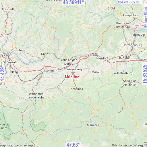
Mühling GPS coordinates[2]
48° 6' 6.12" North, 15° 7' 55.632" East
| Map corner | latitude | longitude |
|---|---|---|
| Upper-left | 48.56911°, | 14.429° |
| Center: | 48.1017°, | 15.13212° |
| Lower-right: | 47.63°, | 15.83525° |
| Map W x H: | 104.4×104.4 km | = 64.9×64.9mi |
| max Lat: | 48.98333° ⇑27.1% North |
| Mühling: | 48.1017° |
| min Lat: | ⇓72.9% South 46.48841° |
| min Long | Mühling | max Long |
| 9.57802° | 15.13212° | 17.1° |
| W 56.4%⇐ | ⇒43.6% E |
Elevation
Elevation of Mühling is 267 m = 876 ft, and this is 238.5 m = 782 ft below average elevation for this country.
| Max E: |
2140 m = 7021 ft | 81.7% |
| Avg. | 505.5 m = 1658 ft | |
| Mühling | 267 m = 876 ft | |
Min E: |
118 m = 387 ft | 18.3% |
See also: Austria elevation on elevation.city.
Geographical zone
Mühling is located in North temperate zone (between Tropic of Cancer and the Arctic Circle). Distance of this North polar circle is 2052.8 km =1275.6 mi to North.| Distance of | km | miles | from Mühling |
|---|---|---|---|
| North Pole | 4658.7 | 2894.8 | to North |
| Arctic Circle | 2052.8 | 1275.6 | to North |
| Tropic Cancer | 2742.5 | 1704.1 | to South |
| Equator | 5348.4 | 3323.3 | to South |


Nearby cities:
15 places around Mühling: (largest is in red/bold)
• Bergland
7.2 km =4.5 mi,  33°
33°
• Erlauf
9.8 km =6.1 mi,  22°
22°
• Gottsdorf
9.9 km =6.2 mi,  349°
349°
• Gries bei Oberndorf
7.2 km =4.5 mi,  124°
124°
• Göttsbach
8.7 km =5.4 mi,  326°
326°
• Höfling
8.8 km =5.5 mi,  233°
233°
• Neumarkt an der Ybbs
7.1 km =4.4 mi,  308°
308°
• Oberndorf an der Melk
8 km =5 mi, 121°
• Petzenkirchen
5.3 km =3.3 mi, 18°
• Purgstall
4.8 km =3 mi,  177°
177°
• Steinakirchen am Forst
7.2 km =4.5 mi,  240°
240°
• Weinzierl
2.9 km =1.8 mi, 351°
• Wieselburg
3.5 km =2.2 mi,  1°
1°
• Wolfpassing
5.7 km =3.5 mi, 242°
• Ybbs an der Donau
8.1 km =5 mi, 333°
Sources, notices
• [Note1] Compared only with cities in Austria existing in our database
• [Src1] Map data: © OpenStreetMap contributors (CC-BY-SA)
• [Src2] Other city data from geonames.org with taken over terms of usage.
• [Src3] Geographical zone / Annual Mean Temperature by Robert A. Rohde @ Wikipedia
