Wildalpen geodata
Wildalpen (Styria) is a seat of a third-order administrative division; located in Austria in Europe/Vienna (GMT+2) time zone. With population of 464 people, there are 2546 cities with bigger population in this country. Compared to other cities in Austria, 51.9% of cities are located further ↓South; 54.1% of cities are located further ←West and 86.3% of cities have lower elevation than Wildalpen. Note1


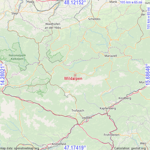
Wildalpen GPS coordinates[2]
47° 39' 0" North, 14° 58' 59.988" East
| Map corner | latitude | longitude |
|---|---|---|
| Upper-left | 48.12152°, | 14.28021° |
| Center: | 47.65°, | 14.98333° |
| Lower-right: | 47.17419°, | 15.68646° |
| Map W x H: | 105.3×105.3 km | = 65.4×65.4mi |
| max Lat: | 48.98333° ⇑48.1% North |
| Wildalpen: | 47.65° |
| min Lat: | ⇓51.9% South 46.48841° |
| min Long | Wildalpen | max Long |
| 9.57802° | 14.98333° | 17.1° |
| W 54.1%⇐ | ⇒45.9% E |
Elevation
Elevation of Wildalpen is 818 m = 2684 ft, and this is 312.5 m = 1025 ft above average elevation for this country.
| Max E: |
2140 m = 7021 ft | 13.7% |
| Wildalpen | 818 m 2684 ft | |
| Avg. | 505.5 m = 1658 ft | |
Min E: |
118 m = 387 ft | 86.3% |
See also: Austria elevation on elevation.city.
Geographical zone
Wildalpen is located in North temperate zone (between Tropic of Cancer and the Arctic Circle). Distance of this North polar circle is 2103 km =1306.7 mi to North.| Distance of | km | miles | from Wildalpen |
|---|---|---|---|
| North Pole | 4708.9 | 2926 | to North |
| Arctic Circle | 2103 | 1306.7 | to North |
| Tropic Cancer | 2692.3 | 1672.9 | to South |
| Equator | 5298.2 | 3292.1 | to South |


Nearby cities:
15 places around Wildalpen: (largest is in red/bold)
• Aflenz Kurort
22.6 km =14 mi,  122°
122°
• Eisenerz
15 km =9.3 mi,  210°
210°
• Fölz
22.8 km =14.2 mi, 124°
• Gams bei Hieflau
15.1 km =9.4 mi,  277°
277°
• Göstling an der Ybbs
17.7 km =11 mi,  348°
348°
• Hieflau
18.5 km =11.5 mi,  254°
254°
• Hollenstein an der Ybbs
23.2 km =14.4 mi,  317°
317°
• Landl
18.8 km =11.7 mi,  272°
272°
• Lunz am See
23.7 km =14.7 mi,  8°
8°
• Palbersdorf
22.8 km =14.2 mi, 124°
• Palfau
14.8 km =9.2 mi,  292°
292°
• Sankt Ilgen
17.7 km =11 mi,  128°
128°
• Sankt Katharein an der Laming
24.1 km =15 mi,  145°
145°
• Thörl
23.1 km =14.4 mi, 128°
• Vordernberg
18 km =11.2 mi,  177°
177°
Sources, notices
• [Note1] Compared only with cities in Austria existing in our database
• [Src1] Map data: © OpenStreetMap contributors (CC-BY-SA)
• [Src2] Other city data from geonames.org with taken over terms of usage.
• [Src3] Geographical zone / Annual Mean Temperature by Robert A. Rohde @ Wikipedia
