Eisenerz geodata
Eisenerz (Styria) is a seat of a third-order administrative division; located in Austria in Europe/Vienna (GMT+2) time zone. With population of 4,048 people, there are 256 cities with bigger population in this country. Compared to other cities in Austria, 52.3% of cities are located further ↑North; 52.9% of cities are located further ←West and 88.6% of cities have lower elevation than Eisenerz. Note1


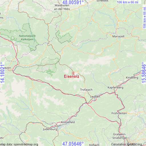
Eisenerz GPS coordinates[2]
47° 31' 59.988" North, 14° 52' 59.988" East
| Map corner | latitude | longitude |
|---|---|---|
| Upper-left | 48.00591°, | 14.18021° |
| Center: | 47.53333°, | 14.88333° |
| Lower-right: | 47.05646°, | 15.58646° |
| Map W x H: | 105.6×105.6 km | = 65.6×65.6mi |
| max Lat: | 48.98333° ⇑52.3% North |
| Eisenerz: | 47.53333° |
| min Lat: | ⇓47.7% South 46.48841° |
| min Long | Eisenerz | max Long |
| 9.57802° | 14.88333° | 17.1° |
| W 52.9%⇐ | ⇒47.1% E |
Elevation
Elevation of Eisenerz is 854 m = 2802 ft, and this is 348.5 m = 1143 ft above average elevation for this country.
| Max E: |
2140 m = 7021 ft | 11.4% |
| Eisenerz | 854 m 2802 ft | |
| Avg. | 505.5 m = 1658 ft | |
Min E: |
118 m = 387 ft | 88.6% |
See also: Austria elevation on elevation.city.
Geographical zone
Eisenerz is located in North temperate zone (between Tropic of Cancer and the Arctic Circle). Distance of this North polar circle is 2116 km =1314.8 mi to North.| Distance of | km | miles | from Eisenerz |
|---|---|---|---|
| North Pole | 4721.9 | 2934.1 | to North |
| Arctic Circle | 2116 | 1314.8 | to North |
| Tropic Cancer | 2679.3 | 1664.8 | to South |
| Equator | 5285.2 | 3284.1 | to South |


Nearby cities:
15 places around Eisenerz: (largest is in red/bold)
• Gams bei Hieflau
16.6 km =10.3 mi,  333°
333°
• Hessenberg
18.1 km =11.2 mi,  146°
146°
• Hieflau
13.2 km =8.2 mi,  308°
308°
• Kalwang
15.3 km =9.5 mi,  219°
219°
• Kammern im Liesingtal
15.7 km =9.8 mi,  174°
174°
• Laintal
16.7 km =10.4 mi,  135°
135°
• Landl
17.8 km =11.1 mi,  320°
320°
• Mautern in Steiermark
15.3 km =9.5 mi,  194°
194°
• Sankt Peter-Freienstein
19.5 km =12.1 mi, 148°
• Timmersdorf
18.6 km =11.6 mi,  158°
158°
• Traboch
19 km =11.8 mi, 155°
• Trofaiach
15.2 km =9.4 mi, 142°
• Vordernberg
9.7 km =6 mi,  121°
121°
• Wald am Schoberpaß
18.2 km =11.3 mi,  239°
239°
• Wildalpen
15 km =9.3 mi,  30°
30°
Sources, notices
• [Note1] Compared only with cities in Austria existing in our database
• [Src1] Map data: © OpenStreetMap contributors (CC-BY-SA)
• [Src2] Other city data from geonames.org with taken over terms of usage.
• [Src3] Geographical zone / Annual Mean Temperature by Robert A. Rohde @ Wikipedia
