Weichstetten geodata
Weichstetten (Upper Austria) is a populated place; located in Austria in Europe/Vienna (GMT+2) time zone. With population of 888 people, there are 1453 cities with bigger population in this country. Compared to other cities in Austria, 73.8% of cities are located further ↓South; 57.3% of cities are located further →East and 64.7% of cities have higher elevation than Weichstetten. Note1
Administrative division(s):
- Level 1: Upper Austria
- Level 2: Politischer Bezirk Linz-Land
- Level 3: Sankt Marien


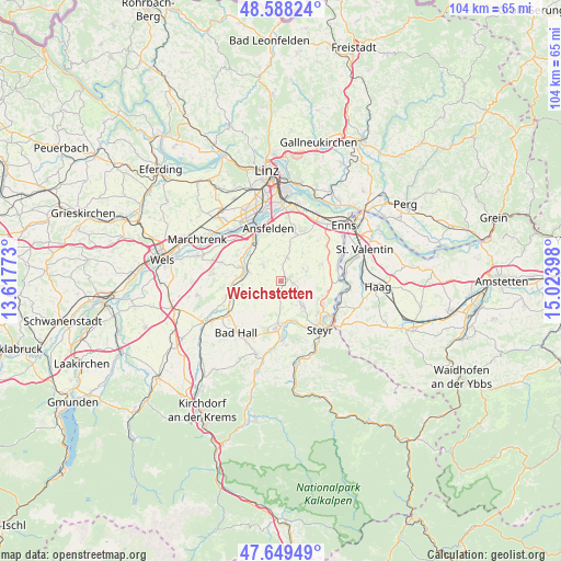
Weichstetten GPS coordinates[2]
48° 7' 15.636" North, 14° 19' 15.06" East
| Map corner | latitude | longitude |
|---|---|---|
| Upper-left | 48.58824°, | 13.61773° |
| Center: | 48.12101°, | 14.32085° |
| Lower-right: | 47.64949°, | 15.02398° |
| Map W x H: | 104.4×104.4 km | = 64.9×64.9mi |
| max Lat: | 48.98333° ⇑26.2% North |
| Weichstetten: | 48.12101° |
| min Lat: | ⇓73.8% South 46.48841° |
| min Long | Weichstetten | max Long |
| 9.57802° | 14.32085° | 17.1° |
| W 42.7%⇐ | ⇒57.3% E |
Elevation
Elevation of Weichstetten is 355 m = 1165 ft, and this is 150.5 m = 494 ft below average elevation for this country.
| Max E: |
2140 m = 7021 ft | 64.7% |
| Avg. | 505.5 m = 1658 ft | |
| Weichstetten | 355 m = 1165 ft | |
Min E: |
118 m = 387 ft | 35.3% |
See also: Austria elevation on elevation.city.
Geographical zone
Weichstetten is located in North temperate zone (between Tropic of Cancer and the Arctic Circle). Distance of this North polar circle is 2050.6 km =1274.2 mi to North.| Distance of | km | miles | from Weichstetten |
|---|---|---|---|
| North Pole | 4656.5 | 2893.4 | to North |
| Arctic Circle | 2050.6 | 1274.2 | to North |
| Tropic Cancer | 2744.6 | 1705.4 | to South |
| Equator | 5350.6 | 3324.7 | to South |


Nearby cities:
15 places around Weichstetten: (largest is in red/bold)
• Dietach
7.9 km =4.9 mi,  115°
115°
• Dietachdorf
9 km =5.6 mi, 117°
• Hofkirchen im Traunkreis
4.9 km =3 mi,  59°
59°
• Kematen an der Krems
9.5 km =5.9 mi,  263°
263°
• Kremsdorf
9.8 km =6.1 mi,  333°
333°
• Losensteinleithen
2.8 km =1.7 mi,  102°
102°
• Neuhofen an der Krems
7.2 km =4.5 mi,  285°
285°
• Neuzeug
7.9 km =4.9 mi,  173°
173°
• Niederneukirchen
4.7 km =2.9 mi,  17°
17°
• Nöstlbach
7.5 km =4.7 mi,  312°
312°
• Piberbach
7 km =4.3 mi, 264°
• Sankt Marien
4.4 km =2.7 mi, 313°
• Sierning
8.7 km =5.4 mi,  185°
185°
• Weifersdorf
6.5 km =4 mi,  276°
276°
• Wolfern
5.7 km =3.5 mi,  138°
138°
Sources, notices
• [Note1] Compared only with cities in Austria existing in our database
• [Src1] Map data: © OpenStreetMap contributors (CC-BY-SA)
• [Src2] Other city data from geonames.org with taken over terms of usage.
• [Src3] Geographical zone / Annual Mean Temperature by Robert A. Rohde @ Wikipedia
