Losensteinleithen geodata
Losensteinleithen (Upper Austria) is a populated place; located in Austria in Europe/Vienna (GMT+2) time zone. With population of 557 people, there are 2289 cities with bigger population in this country. Compared to other cities in Austria, 73.5% of cities are located further ↓South; 56.6% of cities are located further →East and 64.1% of cities have higher elevation than Losensteinleithen. Note1
Administrative division(s):
- Level 1: Upper Austria
- Level 2: Politischer Bezirk Steyr-Land
- Level 3: Wolfern


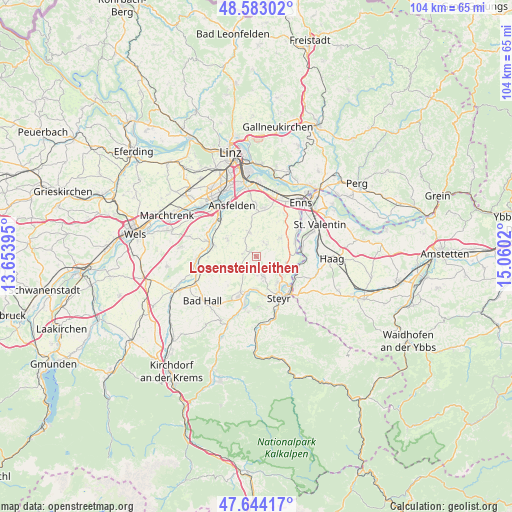
Losensteinleithen GPS coordinates[2]
48° 6' 56.664" North, 14° 21' 25.452" East
| Map corner | latitude | longitude |
|---|---|---|
| Upper-left | 48.58302°, | 13.65395° |
| Center: | 48.11574°, | 14.35707° |
| Lower-right: | 47.64417°, | 15.0602° |
| Map W x H: | 104.4×104.4 km | = 64.9×64.9mi |
| max Lat: | 48.98333° ⇑26.5% North |
| Losensteinleithen: | 48.11574° |
| min Lat: | ⇓73.5% South 46.48841° |
| min Long | Losensteinleith | max Long |
| 9.57802° | 14.35707° | 17.1° |
| W 43.4%⇐ | ⇒56.6% E |
Elevation
Elevation of Losensteinleithen is 358 m = 1175 ft, and this is 147.5 m = 484 ft below average elevation for this country.
| Max E: |
2140 m = 7021 ft | 64.1% |
| Avg. | 505.5 m = 1658 ft | |
| Losensteinleithen | 358 m = 1175 ft | |
Min E: |
118 m = 387 ft | 35.9% |
See also: Austria elevation on elevation.city.
Geographical zone
Losensteinleithen is located in North temperate zone (between Tropic of Cancer and the Arctic Circle). Distance of this North polar circle is 2051.2 km =1274.6 mi to North.| Distance of | km | miles | from Losensteinleithen |
|---|---|---|---|
| North Pole | 4657.1 | 2893.8 | to North |
| Arctic Circle | 2051.2 | 1274.6 | to North |
| Tropic Cancer | 2744 | 1705 | to South |
| Equator | 5350 | 3324.3 | to South |


Nearby cities:
15 places around Losensteinleithen: (largest is in red/bold)
• Dietach
5.2 km =3.2 mi,  122°
122°
• Dietachdorf
6.4 km =4 mi, 123°
• Ernsthofen
9.3 km =5.8 mi,  80°
80°
• Haidershofen
8.9 km =5.5 mi, 119°
• Hofkirchen im Traunkreis
3.4 km =2.1 mi,  26°
26°
• Kronstorf
8.4 km =5.2 mi,  68°
68°
• Neuzeug
7.5 km =4.7 mi,  193°
193°
• Niederneukirchen
5.2 km =3.2 mi,  345°
345°
• Piberbach
9.7 km =6 mi,  269°
269°
• Sankt Marien
6.9 km =4.3 mi,  301°
301°
• Sierning
8.8 km =5.5 mi,  203°
203°
• Steyr
9.4 km =5.8 mi,  149°
149°
• Weichstetten
2.8 km =1.7 mi,  282°
282°
• Weifersdorf
9.3 km =5.8 mi, 278°
• Wolfern
3.8 km =2.4 mi,  163°
163°
Sources, notices
• [Note1] Compared only with cities in Austria existing in our database
• [Src1] Map data: © OpenStreetMap contributors (CC-BY-SA)
• [Src2] Other city data from geonames.org with taken over terms of usage.
• [Src3] Geographical zone / Annual Mean Temperature by Robert A. Rohde @ Wikipedia
