Wals geodata
Wals (Salzburg) is a populated place; located in Austria in Europe/Vienna (GMT+2) time zone. With population of 3,626 people, there are 297 cities with bigger population in this country. Compared to other cities in Austria, 56.5% of cities are located further ↓South; 83.5% of cities are located further →East and 51.9% of cities have higher elevation than Wals. Note1
Administrative division(s):
- Level 1: Salzburg
- Level 2: Politischer Bezirk Salzburg-Umgebung
- Level 3: Wals-Siezenheim


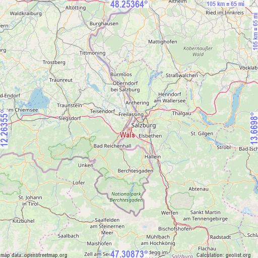
Wals GPS coordinates[2]
47° 46' 59.988" North, 12° 58' 0.012" East
| Map corner | latitude | longitude |
|---|---|---|
| Upper-left | 48.25364°, | 12.26355° |
| Center: | 47.78333°, | 12.96667° |
| Lower-right: | 47.30873°, | 13.6698° |
| Map W x H: | 105.1×105.1 km | = 65.3×65.3mi |
| max Lat: | 48.98333° ⇑43.5% North |
| Wals: | 47.78333° |
| min Lat: | ⇓56.5% South 46.48841° |
| min Long | Wals | max Long |
| 9.57802° | 12.96667° | 17.1° |
| W 16.5%⇐ | ⇒83.5% E |
Elevation
Elevation of Wals is 439 m = 1440 ft, and this is 66.5 m = 218 ft below average elevation for this country.
| Max E: |
2140 m = 7021 ft | 51.9% |
| Avg. | 505.5 m = 1658 ft | |
| Wals | 439 m = 1440 ft | |
Min E: |
118 m = 387 ft | 48.1% |
See also: Austria elevation on elevation.city.
Geographical zone
Wals is located in North temperate zone (between Tropic of Cancer and the Arctic Circle). Distance of this North polar circle is 2088.2 km =1297.5 mi to North.| Distance of | km | miles | from Wals |
|---|---|---|---|
| North Pole | 4694.1 | 2916.8 | to North |
| Arctic Circle | 2088.2 | 1297.5 | to North |
| Tropic Cancer | 2707.1 | 1682.1 | to South |
| Equator | 5313 | 3301.3 | to South |


Nearby cities:
15 places around Wals: (largest is in red/bold)
• Anif
8.3 km =5.2 mi,  116°
116°
• Bergheim
7.5 km =4.7 mi,  41°
41°
• Glanegg
4.5 km =2.8 mi,  146°
146°
• Gois
1.9 km =1.2 mi,  180°
180°
• Grossgmain
7.9 km =4.9 mi,  213°
213°
• Grödig
7.3 km =4.5 mi,  133°
133°
• Himmelreich
2.2 km =1.4 mi,  33°
33°
• Käferheim
1.2 km =0.7 mi,  270°
270°
• Neu-Anif
8.3 km =5.2 mi, 129°
• Salzburg
6 km =3.7 mi,  72°
72°
• Sankt Leonhard
8.7 km =5.4 mi,  137°
137°
• Siezenheim
4 km =2.5 mi, 26°
• Viehhausen
1.2 km =0.7 mi,  90°
90°
• Walserberg
1.3 km =0.8 mi, 213°
• Walserfeld
1.4 km =0.9 mi,  45°
45°
Sources, notices
• [Note1] Compared only with cities in Austria existing in our database
• [Src1] Map data: © OpenStreetMap contributors (CC-BY-SA)
• [Src2] Other city data from geonames.org with taken over terms of usage.
• [Src3] Geographical zone / Annual Mean Temperature by Robert A. Rohde @ Wikipedia
