Gois geodata
Gois (Salzburg) is a populated place; located in Austria in Europe/Vienna (GMT+2) time zone. With population of 628 people, there are 2040 cities with bigger population in this country. Compared to other cities in Austria, 55.8% of cities are located further ↓South; 83.5% of cities are located further →East and 53% of cities have higher elevation than Gois. Note1
Administrative division(s):
- Level 1: Salzburg
- Level 2: Politischer Bezirk Salzburg-Umgebung
- Level 3: Wals-Siezenheim


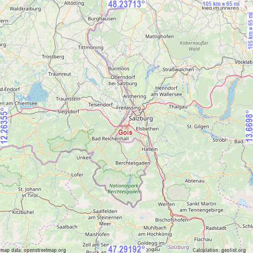
Gois GPS coordinates[2]
47° 46' 0.012" North, 12° 58' 0.012" East
| Map corner | latitude | longitude |
|---|---|---|
| Upper-left | 48.23713°, | 12.26355° |
| Center: | 47.76667°, | 12.96667° |
| Lower-right: | 47.29192°, | 13.6698° |
| Map W x H: | 105.1×105.1 km | = 65.3×65.3mi |
| max Lat: | 48.98333° ⇑44.2% North |
| Gois: | 47.76667° |
| min Lat: | ⇓55.8% South 46.48841° |
| min Long | Gois | max Long |
| 9.57802° | 12.96667° | 17.1° |
| W 16.5%⇐ | ⇒83.5% E |
Elevation
Elevation of Gois is 435 m = 1427 ft, and this is 70.5 m = 231 ft below average elevation for this country.
| Max E: |
2140 m = 7021 ft | 53% |
| Avg. | 505.5 m = 1658 ft | |
| Gois | 435 m = 1427 ft | |
Min E: |
118 m = 387 ft | 47% |
See also: Austria elevation on elevation.city.
Geographical zone
Gois is located in North temperate zone (between Tropic of Cancer and the Arctic Circle). Distance of this North polar circle is 2090 km =1298.7 mi to North.| Distance of | km | miles | from Gois |
|---|---|---|---|
| North Pole | 4695.9 | 2917.9 | to North |
| Arctic Circle | 2090 | 1298.7 | to North |
| Tropic Cancer | 2705.2 | 1680.9 | to South |
| Equator | 5311.2 | 3300.2 | to South |


Nearby cities:
15 places around Gois: (largest is in red/bold)
• Anif
7.7 km =4.8 mi,  103°
103°
• Glanegg
3.1 km =1.9 mi,  126°
126°
• Grossgmain
6.4 km =4 mi,  222°
222°
• Grödig
6.1 km =3.8 mi,  120°
120°
• Himmelreich
3.9 km =2.4 mi,  18°
18°
• Käferheim
2.2 km =1.4 mi,  326°
326°
• Neu-Anif
7.3 km =4.5 mi, 117°
• Niederalm
8.3 km =5.2 mi, 120°
• Salzburg
6.8 km =4.2 mi,  57°
57°
• Sankt Leonhard
7.5 km =4.7 mi, 127°
• Siezenheim
5.7 km =3.5 mi, 18°
• Viehhausen
2.2 km =1.4 mi,  33°
33°
• Wals
1.9 km =1.2 mi,  0°
0°
• Walserberg
1.1 km =0.7 mi,  319°
319°
• Walserfeld
3 km =1.9 mi, 19°
Sources, notices
• [Note1] Compared only with cities in Austria existing in our database
• [Src1] Map data: © OpenStreetMap contributors (CC-BY-SA)
• [Src2] Other city data from geonames.org with taken over terms of usage.
• [Src3] Geographical zone / Annual Mean Temperature by Robert A. Rohde @ Wikipedia
