Unterweitersdorf geodata
Unterweitersdorf (Upper Austria) is a populated place; located in Austria in Europe/Vienna (GMT+2) time zone. With population of 842 people, there are 1532 cities with bigger population in this country. Compared to other cities in Austria, 89.4% of cities are located further ↓South; 54% of cities are located further →East and 69.1% of cities have higher elevation than Unterweitersdorf. Note1
Administrative division(s):
- Level 1: Upper Austria
- Level 2: Politischer Bezirk Freistadt
- Level 3: Unterweitersdorf


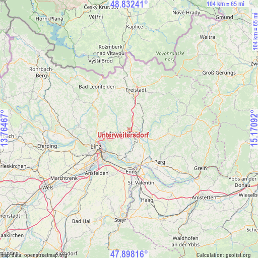
Unterweitersdorf GPS coordinates[2]
48° 22' 2.748" North, 14° 28' 4.044" East
| Map corner | latitude | longitude |
|---|---|---|
| Upper-left | 48.83241°, | 13.76467° |
| Center: | 48.36743°, | 14.46779° |
| Lower-right: | 47.89816°, | 15.17092° |
| Map W x H: | 103.9×103.9 km | = 64.6×64.6mi |
| max Lat: | 48.98333° ⇑10.6% North |
| Unterweitersdorf: | 48.36743° |
| min Lat: | ⇓89.4% South 46.48841° |
| min Long | Unterweitersdor | max Long |
| 9.57802° | 14.46779° | 17.1° |
| W 46%⇐ | ⇒54% E |
Elevation
Elevation of Unterweitersdorf is 333 m = 1093 ft, and this is 172.5 m = 566 ft below average elevation for this country.
| Max E: |
2140 m = 7021 ft | 69.1% |
| Avg. | 505.5 m = 1658 ft | |
| Unterweitersdorf | 333 m = 1093 ft | |
Min E: |
118 m = 387 ft | 30.9% |
See also: Austria elevation on elevation.city.
Geographical zone
Unterweitersdorf is located in North temperate zone (between Tropic of Cancer and the Arctic Circle). Distance of this North polar circle is 2023.2 km =1257.2 mi to North.| Distance of | km | miles | from Unterweitersdorf |
|---|---|---|---|
| North Pole | 4629.1 | 2876.4 | to North |
| Arctic Circle | 2023.2 | 1257.2 | to North |
| Tropic Cancer | 2772 | 1722.4 | to South |
| Equator | 5378 | 3341.7 | to South |


Nearby cities:
15 places around Unterweitersdorf: (largest is in red/bold)
• Alberndorf in der Riedmark
5.8 km =3.6 mi,  317°
317°
• Altenberg bei Linz
8.7 km =5.4 mi,  273°
273°
• Engerwitzdorf
3.1 km =1.9 mi,  217°
217°
• Gallneukirchen
4.1 km =2.5 mi,  248°
248°
• Grünbichl
4.6 km =2.9 mi,  116°
116°
• Hagenberg im Mühlkreis
3.6 km =2.2 mi,  89°
89°
• Haid
5.3 km =3.3 mi,  214°
214°
• Innertreffling
7.2 km =4.5 mi, 250°
• Katsdorf
5.5 km =3.4 mi,  174°
174°
• Linzerberg
5.1 km =3.2 mi,  239°
239°
• Mittertreffling
8.2 km =5.1 mi, 247°
• Neumarkt im Mühlkreis
6.9 km =4.3 mi,  10°
10°
• Pregarten
5 km =3.1 mi,  106°
106°
• Schweinbach
4.5 km =2.8 mi,  228°
228°
• Wartberg ob der Aist
3.7 km =2.3 mi,  126°
126°
Sources, notices
• [Note1] Compared only with cities in Austria existing in our database
• [Src1] Map data: © OpenStreetMap contributors (CC-BY-SA)
• [Src2] Other city data from geonames.org with taken over terms of usage.
• [Src3] Geographical zone / Annual Mean Temperature by Robert A. Rohde @ Wikipedia
