Katsdorf geodata
Katsdorf (Upper Austria) is a populated place; located in Austria in Europe/Vienna (GMT+2) time zone. With population of 1,289 people, there are 976 cities with bigger population in this country. Compared to other cities in Austria, 86.8% of cities are located further ↓South; 53.9% of cities are located further →East and 75% of cities have higher elevation than Katsdorf. Note1
Administrative division(s):
- Level 1: Upper Austria
- Level 2: Politischer Bezirk Perg
- Level 3: Katsdorf


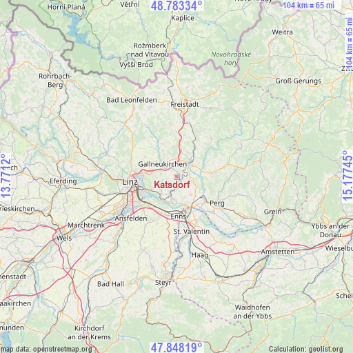
Katsdorf GPS coordinates[2]
48° 19' 4.476" North, 14° 28' 27.552" East
| Map corner | latitude | longitude |
|---|---|---|
| Upper-left | 48.78334°, | 13.7712° |
| Center: | 48.31791°, | 14.47432° |
| Lower-right: | 47.84819°, | 15.17745° |
| Map W x H: | 104×104 km | = 64.6×64.6mi |
| max Lat: | 48.98333° ⇑13.2% North |
| Katsdorf: | 48.31791° |
| min Lat: | ⇓86.8% South 46.48841° |
| min Long | Katsdorf | max Long |
| 9.57802° | 14.47432° | 17.1° |
| W 46.1%⇐ | ⇒53.9% E |
Elevation
Elevation of Katsdorf is 303 m = 994 ft, and this is 202.5 m = 664 ft below average elevation for this country.
| Max E: |
2140 m = 7021 ft | 75% |
| Avg. | 505.5 m = 1658 ft | |
| Katsdorf | 303 m = 994 ft | |
Min E: |
118 m = 387 ft | 25% |
See also: Austria elevation on elevation.city.
Geographical zone
Katsdorf is located in North temperate zone (between Tropic of Cancer and the Arctic Circle). Distance of this North polar circle is 2028.7 km =1260.6 mi to North.| Distance of | km | miles | from Katsdorf |
|---|---|---|---|
| North Pole | 4634.6 | 2879.8 | to North |
| Arctic Circle | 2028.7 | 1260.6 | to North |
| Tropic Cancer | 2766.5 | 1719 | to South |
| Equator | 5372.4 | 3338.3 | to South |


Nearby cities:
15 places around Katsdorf: (largest is in red/bold)
• Blindendorf
5 km =3.1 mi,  167°
167°
• Engerwitzdorf
3.8 km =2.4 mi,  321°
321°
• Gallneukirchen
5.9 km =3.7 mi,  312°
312°
• Grünbichl
5 km =3.1 mi,  46°
46°
• Hagenberg im Mühlkreis
6.4 km =4 mi,  29°
29°
• Haid
3.6 km =2.2 mi,  287°
287°
• Linzerberg
5.7 km =3.5 mi,  300°
300°
• Luftenberg an der Donau
6.6 km =4.1 mi,  223°
223°
• Pregarten
5.9 km =3.7 mi, 46°
• Ried in der Riedmark
6.5 km =4 mi,  142°
142°
• Sankt Georgen an der Gusen
5.4 km =3.4 mi,  199°
199°
• Schweinbach
4.6 km =2.9 mi, 303°
• Statzing
5.8 km =3.6 mi,  214°
214°
• Unterweitersdorf
5.5 km =3.4 mi,  354°
354°
• Wartberg ob der Aist
4.2 km =2.6 mi,  36°
36°
Sources, notices
• [Note1] Compared only with cities in Austria existing in our database
• [Src1] Map data: © OpenStreetMap contributors (CC-BY-SA)
• [Src2] Other city data from geonames.org with taken over terms of usage.
• [Src3] Geographical zone / Annual Mean Temperature by Robert A. Rohde @ Wikipedia
