Gallneukirchen geodata
Gallneukirchen (Upper Austria) is a seat of a third-order administrative division; located in Austria in Europe/Vienna (GMT+2) time zone. With population of 6,492 people, there are 149 cities with bigger population in this country. Compared to other cities in Austria, 88.7% of cities are located further ↓South; 55.4% of cities are located further →East and 67.9% of cities have higher elevation than Gallneukirchen. Note1
Administrative division(s):
- Level 1: Upper Austria
- Level 2: Politischer Bezirk Urfahr-Umgebung
- Level 3: Gallneukirchen


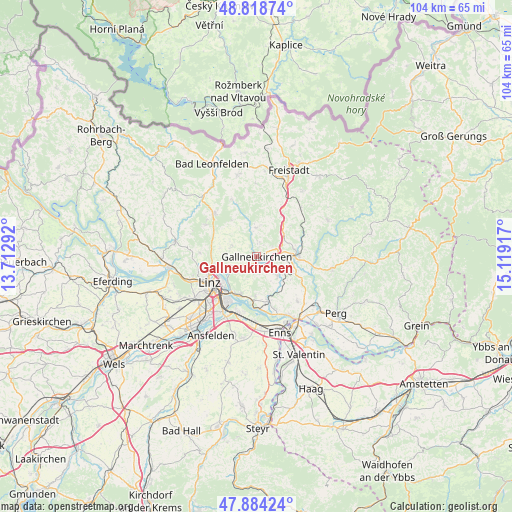
Gallneukirchen GPS coordinates[2]
48° 21' 13.068" North, 14° 24' 57.744" East
| Map corner | latitude | longitude |
|---|---|---|
| Upper-left | 48.81874°, | 13.71292° |
| Center: | 48.35363°, | 14.41604° |
| Lower-right: | 47.88424°, | 15.11917° |
| Map W x H: | 103.9×103.9 km | = 64.6×64.6mi |
| max Lat: | 48.98333° ⇑11.3% North |
| Gallneukirchen: | 48.35363° |
| min Lat: | ⇓88.7% South 46.48841° |
| min Long | Gallneukirchen | max Long |
| 9.57802° | 14.41604° | 17.1° |
| W 44.6%⇐ | ⇒55.4% E |
Elevation
Elevation of Gallneukirchen is 339 m = 1112 ft, and this is 166.5 m = 546 ft below average elevation for this country.
| Max E: |
2140 m = 7021 ft | 67.9% |
| Avg. | 505.5 m = 1658 ft | |
| Gallneukirchen | 339 m = 1112 ft | |
Min E: |
118 m = 387 ft | 32.1% |
See also: Austria elevation on elevation.city.
Geographical zone
Gallneukirchen is located in North temperate zone (between Tropic of Cancer and the Arctic Circle). Distance of this North polar circle is 2024.8 km =1258.2 mi to North.| Distance of | km | miles | from Gallneukirchen |
|---|---|---|---|
| North Pole | 4630.6 | 2877.3 | to North |
| Arctic Circle | 2024.8 | 1258.2 | to North |
| Tropic Cancer | 2770.5 | 1721.5 | to South |
| Equator | 5376.4 | 3340.7 | to South |


Nearby cities:
15 places around Gallneukirchen: (largest is in red/bold)
• Alberndorf in der Riedmark
5.8 km =3.6 mi,  358°
358°
• Altenberg bei Linz
5.3 km =3.3 mi,  293°
293°
• Aussertreffling
5.4 km =3.4 mi,  245°
245°
• Engerwitzdorf
2.1 km =1.3 mi,  116°
116°
• Hagenberg im Mühlkreis
7.6 km =4.7 mi,  77°
77°
• Haid
3 km =1.9 mi,  163°
163°
• Haslach
5.5 km =3.4 mi,  274°
274°
• Innertreffling
3.1 km =1.9 mi, 252°
• Katsdorf
5.9 km =3.7 mi,  132°
132°
• Linzerberg
1.2 km =0.7 mi,  208°
208°
• Mittertreffling
4.1 km =2.5 mi, 246°
• Plesching
6.8 km =4.2 mi,  237°
237°
• Schweinbach
1.6 km =1 mi, 162°
• Unterweitersdorf
4.1 km =2.5 mi,  68°
68°
• Wartberg ob der Aist
6.8 km =4.2 mi,  95°
95°
Sources, notices
• [Note1] Compared only with cities in Austria existing in our database
• [Src1] Map data: © OpenStreetMap contributors (CC-BY-SA)
• [Src2] Other city data from geonames.org with taken over terms of usage.
• [Src3] Geographical zone / Annual Mean Temperature by Robert A. Rohde @ Wikipedia
