Unternalb geodata
Unternalb (Lower Austria) is a populated place; located in Austria in Europe/Vienna (GMT+2) time zone. With population of 706 people, there are 1842 cities with bigger population in this country. Compared to other cities in Austria, 98.8% of cities are located further ↓South; 79% of cities are located further ←West and 87.2% of cities have higher elevation than Unternalb. Note1
Administrative division(s):
- Level 1: Lower Austria
- Level 2: Politischer Bezirk Hollabrunn
- Level 3: Retz


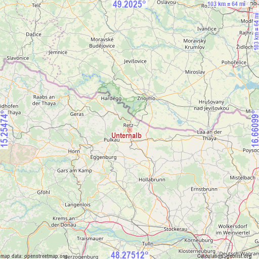
Unternalb GPS coordinates[2]
48° 44' 27.42" North, 15° 57' 28.296" East
| Map corner | latitude | longitude |
|---|---|---|
| Upper-left | 49.2025°, | 15.25474° |
| Center: | 48.74095°, | 15.95786° |
| Lower-right: | 48.27512°, | 16.66099° |
| Map W x H: | 103.1×103.1 km | = 64.1×64.1mi |
| max Lat: | 48.98333° ⇑1.2% North |
| Unternalb: | 48.74095° |
| min Lat: | ⇓98.8% South 46.48841° |
| min Long | Unternalb | max Long |
| 9.57802° | 15.95786° | 17.1° |
| W 79%⇐ | ⇒21% E |
Elevation
Elevation of Unternalb is 234 m = 768 ft, and this is 271.5 m = 891 ft below average elevation for this country.
| Max E: |
2140 m = 7021 ft | 87.2% |
| Avg. | 505.5 m = 1658 ft | |
| Unternalb | 234 m = 768 ft | |
Min E: |
118 m = 387 ft | 12.8% |
See also: Austria elevation on elevation.city.
Geographical zone
Unternalb is located in North temperate zone (between Tropic of Cancer and the Arctic Circle). Distance of this North polar circle is 1981.7 km =1231.4 mi to North.| Distance of | km | miles | from Unternalb |
|---|---|---|---|
| North Pole | 4587.6 | 2850.6 | to North |
| Arctic Circle | 1981.7 | 1231.4 | to North |
| Tropic Cancer | 2813.6 | 1748.3 | to South |
| Equator | 5419.5 | 3367.5 | to South |


Nearby cities:
15 places around Unternalb: (largest is in red/bold)
• Alberndorf
11.4 km =7.1 mi,  113°
113°
• Eggenburg
15.2 km =9.4 mi,  221°
221°
• Guntersdorf
12.2 km =7.6 mi,  146°
146°
• Hadres
13.1 km =8.1 mi, 105°
• Hardegg
14.5 km =9 mi,  326°
326°
• Haugsdorf
9.5 km =5.9 mi, 113°
• Obritz
14.8 km =9.2 mi, 107°
• Pernersdorf
6.3 km =3.9 mi,  136°
136°
• Pulkau
8.2 km =5.1 mi,  240°
240°
• Retz
1.8 km =1.1 mi,  353°
353°
• Röschitz
15 km =9.3 mi, 223°
• Schrattenthal
6.2 km =3.9 mi, 222°
• Unterretzbach
4.2 km =2.6 mi,  47°
47°
• Weitersfeld
11.5 km =7.1 mi,  292°
292°
• Zellerndorf
4.9 km =3 mi,  179°
179°
Sources, notices
• [Note1] Compared only with cities in Austria existing in our database
• [Src1] Map data: © OpenStreetMap contributors (CC-BY-SA)
• [Src2] Other city data from geonames.org with taken over terms of usage.
• [Src3] Geographical zone / Annual Mean Temperature by Robert A. Rohde @ Wikipedia
