Weitersfeld geodata
Weitersfeld (Lower Austria) is a seat of a third-order administrative division; located in Austria in Europe/Vienna (GMT+2) time zone. With population of 630 people, there are 2033 cities with bigger population in this country. Compared to other cities in Austria, 99.2% of cities are located further ↓South; 75% of cities are located further ←West and 55.7% of cities have higher elevation than Weitersfeld. Note1
Administrative division(s):
- Level 1: Lower Austria
- Level 2: Politischer Bezirk Horn
- Level 3: Weitersfeld


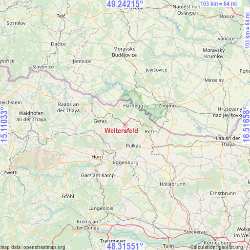
Weitersfeld GPS coordinates[2]
48° 46' 51.492" North, 15° 48' 48.42" East
| Map corner | latitude | longitude |
|---|---|---|
| Upper-left | 49.24215°, | 15.11033° |
| Center: | 48.78097°, | 15.81345° |
| Lower-right: | 48.31551°, | 16.51658° |
| Map W x H: | 103×103 km | = 64×64mi |
| max Lat: | 48.98333° ⇑0.8% North |
| Weitersfeld: | 48.78097° |
| min Lat: | ⇓99.2% South 46.48841° |
| min Long | Weitersfeld | max Long |
| 9.57802° | 15.81345° | 17.1° |
| W 75%⇐ | ⇒25% E |
Elevation
Elevation of Weitersfeld is 414 m = 1358 ft, and this is 91.5 m = 300 ft below average elevation for this country.
| Max E: |
2140 m = 7021 ft | 55.7% |
| Avg. | 505.5 m = 1658 ft | |
| Weitersfeld | 414 m = 1358 ft | |
Min E: |
118 m = 387 ft | 44.3% |
See also: Austria elevation on elevation.city.
Geographical zone
Weitersfeld is located in North temperate zone (between Tropic of Cancer and the Arctic Circle). Distance of this North polar circle is 1977.2 km =1228.6 mi to North.| Distance of | km | miles | from Weitersfeld |
|---|---|---|---|
| North Pole | 4583.1 | 2847.8 | to North |
| Arctic Circle | 1977.2 | 1228.6 | to North |
| Tropic Cancer | 2818 | 1751 | to South |
| Equator | 5423.9 | 3370.3 | to South |


Nearby cities:
15 places around Weitersfeld: (largest is in red/bold)
• Drosendorf
17 km =10.6 mi,  304°
304°
• Eggenburg
15.8 km =9.8 mi,  178°
178°
• Geras
10.5 km =6.5 mi,  279°
279°
• Hardegg
8.1 km =5 mi,  19°
19°
• Langau
9.1 km =5.7 mi,  308°
308°
• Pernegg
15.4 km =9.6 mi,  249°
249°
• Pernersdorf
17.4 km =10.8 mi,  121°
121°
• Pulkau
9.1 km =5.7 mi,  157°
157°
• Retz
10.7 km =6.6 mi,  104°
104°
• Röschitz
15.3 km =9.5 mi, 178°
• Schrattenthal
11 km =6.8 mi,  144°
144°
• Sigmundsherberg
11.8 km =7.3 mi,  203°
203°
• Unternalb
11.5 km =7.1 mi,  112°
112°
• Unterretzbach
13.8 km =8.6 mi, 96°
• Zellerndorf
14.2 km =8.8 mi,  131°
131°
Sources, notices
• [Note1] Compared only with cities in Austria existing in our database
• [Src1] Map data: © OpenStreetMap contributors (CC-BY-SA)
• [Src2] Other city data from geonames.org with taken over terms of usage.
• [Src3] Geographical zone / Annual Mean Temperature by Robert A. Rohde @ Wikipedia
