Pulkau geodata
Pulkau (Lower Austria) is a seat of a third-order administrative division; located in Austria in Europe/Vienna (GMT+2) time zone. With population of 1,017 people, there are 1261 cities with bigger population in this country. Compared to other cities in Austria, 98.3% of cities are located further ↓South; 76.3% of cities are located further ←West and 82.8% of cities have higher elevation than Pulkau. Note1
Administrative division(s):
- Level 1: Lower Austria
- Level 2: Politischer Bezirk Hollabrunn
- Level 3: Pulkau


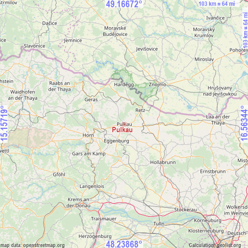
Pulkau GPS coordinates[2]
48° 42' 17.424" North, 15° 51' 37.116" East
| Map corner | latitude | longitude |
|---|---|---|
| Upper-left | 49.16672°, | 15.15719° |
| Center: | 48.70484°, | 15.86031° |
| Lower-right: | 48.23868°, | 16.56344° |
| Map W x H: | 103.2×103.2 km | = 64.1×64.1mi |
| max Lat: | 48.98333° ⇑1.7% North |
| Pulkau: | 48.70484° |
| min Lat: | ⇓98.3% South 46.48841° |
| min Long | Pulkau | max Long |
| 9.57802° | 15.86031° | 17.1° |
| W 76.3%⇐ | ⇒23.7% E |
Elevation
Elevation of Pulkau is 260 m = 853 ft, and this is 245.5 m = 805 ft below average elevation for this country.
| Max E: |
2140 m = 7021 ft | 82.8% |
| Avg. | 505.5 m = 1658 ft | |
| Pulkau | 260 m = 853 ft | |
Min E: |
118 m = 387 ft | 17.2% |
See also: Austria elevation on elevation.city.
Geographical zone
Pulkau is located in North temperate zone (between Tropic of Cancer and the Arctic Circle). Distance of this North polar circle is 1985.7 km =1233.9 mi to North.| Distance of | km | miles | from Pulkau |
|---|---|---|---|
| North Pole | 4591.6 | 2853.1 | to North |
| Arctic Circle | 1985.7 | 1233.9 | to North |
| Tropic Cancer | 2809.6 | 1745.8 | to South |
| Equator | 5415.5 | 3365 | to South |


Nearby cities:
15 places around Pulkau: (largest is in red/bold)
• Eggenburg
7.9 km =4.9 mi,  202°
202°
• Guntersdorf
15.2 km =9.4 mi,  113°
113°
• Haugsdorf
15.9 km =9.9 mi,  88°
88°
• Horn
15.7 km =9.8 mi,  252°
252°
• Maissau
14.8 km =9.2 mi,  188°
188°
• Pernersdorf
11.5 km =7.1 mi, 92°
• Retz
9 km =5.6 mi,  50°
50°
• Röschitz
7.5 km =4.7 mi, 204°
• Schrattenthal
3 km =1.9 mi,  100°
100°
• Sigmundsherberg
8.4 km =5.2 mi, 253°
• Sitzendorf an der Schmida
13.3 km =8.3 mi,  152°
152°
• Unternalb
8.2 km =5.1 mi,  60°
60°
• Unterretzbach
12.3 km =7.6 mi, 56°
• Weitersfeld
9.1 km =5.7 mi,  337°
337°
• Zellerndorf
7.3 km =4.5 mi, 97°
Sources, notices
• [Note1] Compared only with cities in Austria existing in our database
• [Src1] Map data: © OpenStreetMap contributors (CC-BY-SA)
• [Src2] Other city data from geonames.org with taken over terms of usage.
• [Src3] Geographical zone / Annual Mean Temperature by Robert A. Rohde @ Wikipedia
