Guntersdorf geodata
Guntersdorf (Lower Austria) is a seat of a third-order administrative division; located in Austria in Europe/Vienna (GMT+2) time zone. With population of 806 people, there are 1602 cities with bigger population in this country. Compared to other cities in Austria, 97.3% of cities are located further ↓South; 81.5% of cities are located further ←West and 84.7% of cities have higher elevation than Guntersdorf. Note1
Administrative division(s):
- Level 1: Lower Austria
- Level 2: Politischer Bezirk Hollabrunn
- Level 3: Guntersdorf


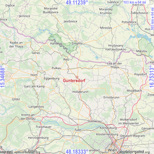
Guntersdorf GPS coordinates[2]
48° 39' 0" North, 16° 3' 0" East
| Map corner | latitude | longitude |
|---|---|---|
| Upper-left | 49.11239°, | 15.34688° |
| Center: | 48.65°, | 16.05° |
| Lower-right: | 48.18333°, | 16.75313° |
| Map W x H: | 103.3×103.3 km | = 64.2×64.2mi |
| max Lat: | 48.98333° ⇑2.7% North |
| Guntersdorf: | 48.65° |
| min Lat: | ⇓97.3% South 46.48841° |
| min Long | Guntersdorf | max Long |
| 9.57802° | 16.05° | 17.1° |
| W 81.5%⇐ | ⇒18.5% E |
Elevation
Elevation of Guntersdorf is 248 m = 814 ft, and this is 257.5 m = 845 ft below average elevation for this country.
| Max E: |
2140 m = 7021 ft | 84.7% |
| Avg. | 505.5 m = 1658 ft | |
| Guntersdorf | 248 m = 814 ft | |
Min E: |
118 m = 387 ft | 15.3% |
See also: Austria elevation on elevation.city.
Geographical zone
Guntersdorf is located in North temperate zone (between Tropic of Cancer and the Arctic Circle). Distance of this North polar circle is 1991.8 km =1237.6 mi to North.| Distance of | km | miles | from Guntersdorf |
|---|---|---|---|
| North Pole | 4597.7 | 2856.9 | to North |
| Arctic Circle | 1991.8 | 1237.6 | to North |
| Tropic Cancer | 2803.5 | 1742 | to South |
| Equator | 5409.4 | 3361.2 | to South |


Nearby cities:
15 places around Guntersdorf: (largest is in red/bold)
• Alberndorf
6.7 km =4.2 mi,  33°
33°
• Großkadolz
12.2 km =7.6 mi,  55°
55°
• Hadres
8.9 km =5.5 mi,  41°
41°
• Haugsdorf
6.7 km =4.2 mi,  16°
16°
• Hollabrunn
11.4 km =7.1 mi,  167°
167°
• Mailberg
10 km =6.2 mi,  74°
74°
• Obritz
9.2 km =5.7 mi,  52°
52°
• Pernersdorf
6.1 km =3.8 mi,  336°
336°
• Schrattenthal
12.3 km =7.6 mi,  296°
296°
• Schöngrabern
5.6 km =3.5 mi,  180°
180°
• Sitzendorf an der Schmida
9.8 km =6.1 mi,  234°
234°
• Sonnberg
13 km =8.1 mi, 180°
• Unternalb
12.2 km =7.6 mi,  326°
326°
• Wullersdorf
4.5 km =2.8 mi,  123°
123°
• Zellerndorf
8.5 km =5.3 mi,  307°
307°
Sources, notices
• [Note1] Compared only with cities in Austria existing in our database
• [Src1] Map data: © OpenStreetMap contributors (CC-BY-SA)
• [Src2] Other city data from geonames.org with taken over terms of usage.
• [Src3] Geographical zone / Annual Mean Temperature by Robert A. Rohde @ Wikipedia
