Hardegg geodata
Hardegg (Lower Austria) is a seat of a third-order administrative division; located in Austria in Europe/Vienna (GMT+2) time zone. With population of 82 people, there are 2930 cities with bigger population in this country. Compared to other cities in Austria, 99.5% of cities are located further ↓South; 76% of cities are located further ←West and 57.7% of cities have higher elevation than Hardegg. Note1
Administrative division(s):
- Level 1: Lower Austria
- Level 2: Politischer Bezirk Hollabrunn
- Level 3: Hardegg


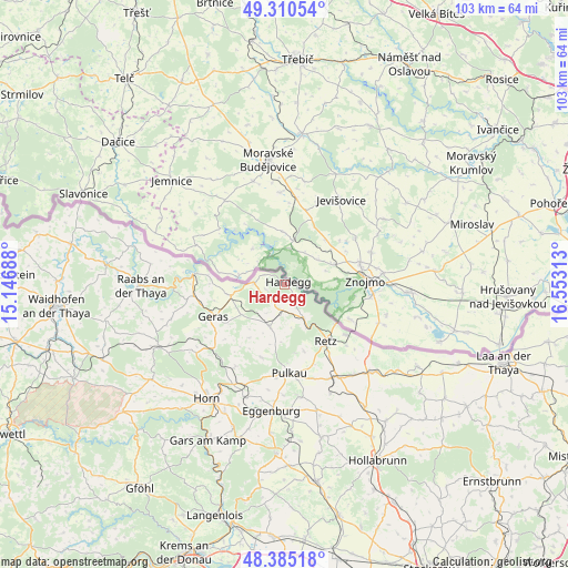
Hardegg GPS coordinates[2]
48° 51' 0" North, 15° 51' 0" East
| Map corner | latitude | longitude |
|---|---|---|
| Upper-left | 49.31054°, | 15.14688° |
| Center: | 48.85°, | 15.85° |
| Lower-right: | 48.38518°, | 16.55313° |
| Map W x H: | 102.9×102.9 km | = 63.9×63.9mi |
| max Lat: | 48.98333° ⇑0.5% North |
| Hardegg: | 48.85° |
| min Lat: | ⇓99.5% South 46.48841° |
| min Long | Hardegg | max Long |
| 9.57802° | 15.85° | 17.1° |
| W 76%⇐ | ⇒24% E |
Elevation
Elevation of Hardegg is 400 m = 1312 ft, and this is 105.5 m = 346 ft below average elevation for this country.
| Max E: |
2140 m = 7021 ft | 57.7% |
| Avg. | 505.5 m = 1658 ft | |
| Hardegg | 400 m = 1312 ft | |
Min E: |
118 m = 387 ft | 42.3% |
See also: Austria elevation on elevation.city.
Geographical zone
Hardegg is located in North temperate zone (between Tropic of Cancer and the Arctic Circle). Distance of this North polar circle is 1969.6 km =1223.9 mi to North.| Distance of | km | miles | from Hardegg |
|---|---|---|---|
| North Pole | 4575.5 | 2843.1 | to North |
| Arctic Circle | 1969.6 | 1223.9 | to North |
| Tropic Cancer | 2825.7 | 1755.8 | to South |
| Equator | 5431.6 | 3375 | to South |


Nearby cities:
15 places around Hardegg: (largest is in red/bold)
• Drosendorf
16.8 km =10.4 mi,  276°
276°
• Geras
14.2 km =8.8 mi,  245°
245°
• Haugsdorf
22.9 km =14.2 mi,  133°
133°
• Japons
21.6 km =13.4 mi, 252°
• Langau
10 km =6.2 mi,  258°
258°
• Pernegg
21.5 km =13.4 mi,  232°
232°
• Pernersdorf
20.7 km =12.9 mi,  143°
143°
• Pulkau
16.2 km =10.1 mi,  177°
177°
• Retz
12.9 km =8 mi, 143°
• Schrattenthal
17.1 km =10.6 mi,  167°
167°
• Sigmundsherberg
19.9 km =12.4 mi,  201°
201°
• Unternalb
14.5 km =9 mi,  146°
146°
• Unterretzbach
14.4 km =8.9 mi, 130°
• Weitersfeld
8.1 km =5 mi, 199°
• Zellerndorf
18.8 km =11.7 mi,  155°
155°
Sources, notices
• [Note1] Compared only with cities in Austria existing in our database
• [Src1] Map data: © OpenStreetMap contributors (CC-BY-SA)
• [Src2] Other city data from geonames.org with taken over terms of usage.
• [Src3] Geographical zone / Annual Mean Temperature by Robert A. Rohde @ Wikipedia
