Unterretzbach geodata
Unterretzbach (Lower Austria) is a populated place; located in Austria in Europe/Vienna (GMT+2) time zone. With population of 632 people, there are 2025 cities with bigger population in this country. Compared to other cities in Austria, 99.1% of cities are located further ↓South; 80.3% of cities are located further ←West and 87% of cities have higher elevation than Unterretzbach. Note1
Administrative division(s):
- Level 1: Lower Austria
- Level 2: Politischer Bezirk Hollabrunn
- Level 3: Retzbach


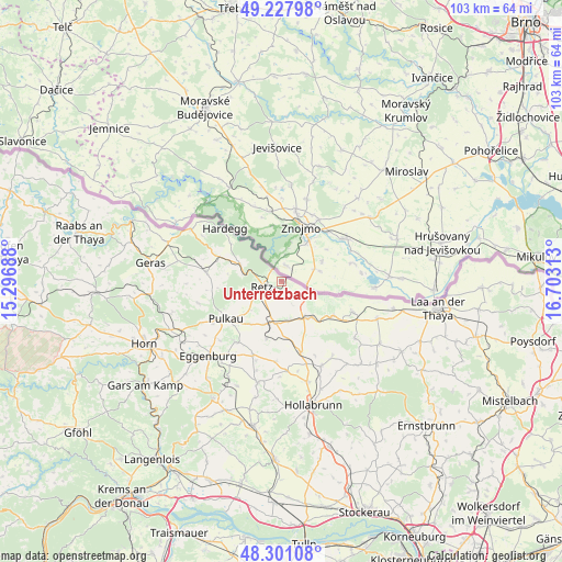
Unterretzbach GPS coordinates[2]
48° 46' 0.012" North, 16° 0' 0" East
| Map corner | latitude | longitude |
|---|---|---|
| Upper-left | 49.22798°, | 15.29688° |
| Center: | 48.76667°, | 16° |
| Lower-right: | 48.30108°, | 16.70313° |
| Map W x H: | 103.1×103.1 km | = 64.1×64.1mi |
| max Lat: | 48.98333° ⇑0.9% North |
| Unterretzbach: | 48.76667° |
| min Lat: | ⇓99.1% South 46.48841° |
| min Long | Unterretzbach | max Long |
| 9.57802° | 16° | 17.1° |
| W 80.3%⇐ | ⇒19.7% E |
Elevation
Elevation of Unterretzbach is 235 m = 771 ft, and this is 270.5 m = 887 ft below average elevation for this country.
| Max E: |
2140 m = 7021 ft | 87% |
| Avg. | 505.5 m = 1658 ft | |
| Unterretzbach | 235 m = 771 ft | |
Min E: |
118 m = 387 ft | 13% |
See also: Austria elevation on elevation.city.
Geographical zone
Unterretzbach is located in North temperate zone (between Tropic of Cancer and the Arctic Circle). Distance of this North polar circle is 1978.8 km =1229.6 mi to North.| Distance of | km | miles | from Unterretzbach |
|---|---|---|---|
| North Pole | 4584.7 | 2848.8 | to North |
| Arctic Circle | 1978.8 | 1229.6 | to North |
| Tropic Cancer | 2816.4 | 1750 | to South |
| Equator | 5422.3 | 3369.3 | to South |


Nearby cities:
15 places around Unterretzbach: (largest is in red/bold)
• Alberndorf
10.4 km =6.5 mi,  135°
135°
• Großkadolz
14.9 km =9.3 mi,  113°
113°
• Guntersdorf
13.5 km =8.4 mi,  164°
164°
• Hadres
11.5 km =7.1 mi,  123°
123°
• Hardegg
14.4 km =8.9 mi,  310°
310°
• Haugsdorf
8.6 km =5.3 mi, 139°
• Mailberg
16.8 km =10.4 mi,  127°
127°
• Obritz
13.3 km =8.3 mi, 123°
• Pernersdorf
7.5 km =4.7 mi,  170°
170°
• Pulkau
12.3 km =7.6 mi,  236°
236°
• Retz
3.5 km =2.2 mi,  252°
252°
• Schrattenthal
10.4 km =6.5 mi,  224°
224°
• Unternalb
4.2 km =2.6 mi,  227°
227°
• Weitersfeld
13.8 km =8.6 mi,  276°
276°
• Zellerndorf
8.4 km =5.2 mi,  201°
201°
Sources, notices
• [Note1] Compared only with cities in Austria existing in our database
• [Src1] Map data: © OpenStreetMap contributors (CC-BY-SA)
• [Src2] Other city data from geonames.org with taken over terms of usage.
• [Src3] Geographical zone / Annual Mean Temperature by Robert A. Rohde @ Wikipedia
