Eichberg-Trautenburg geodata
Eichberg-Trautenburg (Styria) is a populated place; located in Austria in Europe/Vienna (GMT+2) time zone. With population of 558 people, there are 2283 cities with bigger population in this country. Compared to other cities in Austria, 95.5% of cities are located further ↑North; 64.1% of cities are located further ←West and 60.6% of cities have lower elevation than Eichberg-Trautenburg. Note1
Administrative division(s):
- Level 1: Styria
- Level 2: Politischer Bezirk Leibnitz
- Level 3: Leutschach an der Weinstraße


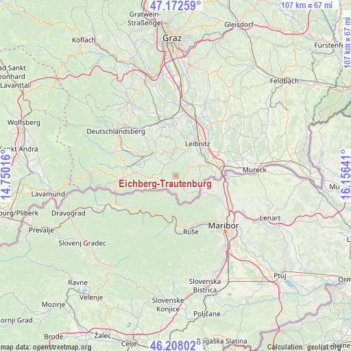
Eichberg-Trautenburg GPS coordinates[2]
46° 41' 32.856" North, 15° 27' 11.808" East
| Map corner | latitude | longitude |
|---|---|---|
| Upper-left | 47.17259°, | 14.75016° |
| Center: | 46.69246°, | 15.45328° |
| Lower-right: | 46.20802°, | 16.15641° |
| Map W x H: | 107.3×107.2 km | = 66.7×66.6mi |
| max Lat: | 48.98333° ⇑95.5% North |
| Eichberg-Trautenburg: | 46.69246° |
| min Lat: | ⇓4.5% South 46.48841° |
| min Long | Eichberg-Traute | max Long |
| 9.57802° | 15.45328° | 17.1° |
| W 64.1%⇐ | ⇒35.9% E |
Elevation
Elevation of Eichberg-Trautenburg is 522 m = 1713 ft, and this is 16.5 m = 54 ft above average elevation for this country.
| Max E: |
2140 m = 7021 ft | 39.4% |
| Eichberg-Trautenburg | 522 m 1713 ft | |
| Avg. | 505.5 m = 1658 ft | |
Min E: |
118 m = 387 ft | 60.6% |
See also: Austria elevation on elevation.city.
Geographical zone
Eichberg-Trautenburg is located in North temperate zone (between Tropic of Cancer and the Arctic Circle). Distance of this North polar circle is 2209.5 km =1372.9 mi to North.| Distance of | km | miles | from Eichberg-Trautenburg |
|---|---|---|---|
| North Pole | 4815.3 | 2992.1 | to North |
| Arctic Circle | 2209.5 | 1372.9 | to North |
| Tropic Cancer | 2585.8 | 1606.7 | to South |
| Equator | 5191.7 | 3226 | to South |


Nearby cities:
15 places around Eichberg-Trautenburg: (largest is in red/bold)
• Arnfels
4.2 km =2.6 mi,  244°
244°
• Fötschach
2.5 km =1.6 mi,  113°
113°
• Gamlitz
8.2 km =5.1 mi,  67°
67°
• Gleinstätten
9.3 km =5.8 mi,  316°
316°
• Großklein
4.9 km =3 mi,  352°
352°
• Heimschuh
8.1 km =5 mi,  21°
21°
• Kitzeck im Sausal
9.8 km =6.1 mi,  0°
0°
• Leutschach
3 km =1.9 mi,  157°
157°
• Oberhaag
9.3 km =5.8 mi,  266°
266°
• Ratsch an der Weinstraße
9 km =5.6 mi,  92°
92°
• Sankt Johann im Saggautal
4.1 km =2.5 mi,  288°
288°
• Schlossberg
5.2 km =3.2 mi,  154°
154°
• Seggauberg
9.6 km =6 mi,  30°
30°
• Sulztal an der Weinstraße
7.4 km =4.6 mi,  97°
97°
• Untergreith
8.3 km =5.2 mi, 288°
Sources, notices
• [Note1] Compared only with cities in Austria existing in our database
• [Src1] Map data: © OpenStreetMap contributors (CC-BY-SA)
• [Src2] Other city data from geonames.org with taken over terms of usage.
• [Src3] Geographical zone / Annual Mean Temperature by Robert A. Rohde @ Wikipedia
