Umhausen geodata
Umhausen (Tyrol) is a seat of a third-order administrative division; located in Austria in Europe/Vienna (GMT+2) time zone. With population of 1,840 people, there are 673 cities with bigger population in this country. Compared to other cities in Austria, 76.6% of cities are located further ↑North; 93.9% of cities are located further →East and 95.7% of cities have lower elevation than Umhausen. Note1


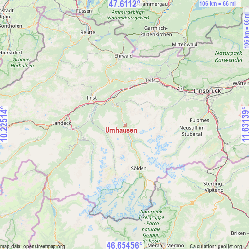
Umhausen GPS coordinates[2]
47° 8' 6.108" North, 10° 55' 41.736" East
| Map corner | latitude | longitude |
|---|---|---|
| Upper-left | 47.6112°, | 10.22514° |
| Center: | 47.13503°, | 10.92826° |
| Lower-right: | 46.65456°, | 11.63139° |
| Map W x H: | 106.4×106.4 km | = 66.1×66.1mi |
| max Lat: | 48.98333° ⇑76.6% North |
| Umhausen: | 47.13503° |
| min Lat: | ⇓23.4% South 46.48841° |
| min Long | Umhausen | max Long |
| 9.57802° | 10.92826° | 17.1° |
| W 6.1%⇐ | ⇒93.9% E |
Elevation
Elevation of Umhausen is 1057 m = 3468 ft, and this is 551.5 m = 1809 ft above average elevation for this country.
| Max E: |
2140 m = 7021 ft | 4.3% |
| Umhausen | 1057 m 3468 ft | |
| Avg. | 505.5 m = 1658 ft | |
Min E: |
118 m = 387 ft | 95.7% |
See also: Austria elevation on elevation.city.
Geographical zone
Umhausen is located in North temperate zone (between Tropic of Cancer and the Arctic Circle). Distance of this North polar circle is 2160.3 km =1342.3 mi to North.| Distance of | km | miles | from Umhausen |
|---|---|---|---|
| North Pole | 4766.1 | 2961.5 | to North |
| Arctic Circle | 2160.3 | 1342.3 | to North |
| Tropic Cancer | 2635 | 1637.3 | to South |
| Equator | 5240.9 | 3256.5 | to South |


Nearby cities:
15 places around Umhausen: (largest is in red/bold)
• Arzl im Pitztal
14.9 km =9.3 mi,  302°
302°
• Haiming
13.2 km =8.2 mi,  345°
345°
• Jerzens
13.8 km =8.6 mi,  277°
277°
• Karres
14.2 km =8.8 mi,  309°
309°
• Karrösten
15.9 km =9.9 mi, 309°
• Längenfeld
7.5 km =4.7 mi,  155°
155°
• Oetz
7.5 km =4.7 mi,  343°
343°
• Roppen
12.4 km =7.7 mi,  317°
317°
• Sankt Leonhard im Pitztal
9.6 km =6 mi,  217°
217°
• Sautens
8.6 km =5.3 mi,  327°
327°
• Silz
14.6 km =9.1 mi,  1°
1°
• Tumpen
4.1 km =2.5 mi, 328°
• Wald
14.2 km =8.8 mi, 300°
• Wenns
15.2 km =9.4 mi, 283°
• Ötztal-Bahnhof
12.4 km =7.7 mi, 331°
Sources, notices
• [Note1] Compared only with cities in Austria existing in our database
• [Src1] Map data: © OpenStreetMap contributors (CC-BY-SA)
• [Src2] Other city data from geonames.org with taken over terms of usage.
• [Src3] Geographical zone / Annual Mean Temperature by Robert A. Rohde @ Wikipedia
