Längenfeld geodata
Längenfeld (Tyrol) is a populated place; located in Austria in Europe/Vienna (GMT+2) time zone. With population of 4,611 people, there are 213 cities with bigger population in this country. Compared to other cities in Austria, 80.6% of cities are located further ↑North; 93.7% of cities are located further →East and 97.7% of cities have lower elevation than Längenfeld. Note1


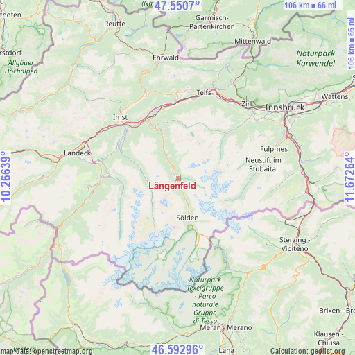
Längenfeld GPS coordinates[2]
47° 4' 26.328" North, 10° 58' 10.236" East
| Map corner | latitude | longitude |
|---|---|---|
| Upper-left | 47.5507°, | 10.26639° |
| Center: | 47.07398°, | 10.96951° |
| Lower-right: | 46.59296°, | 11.67264° |
| Map W x H: | 106.5×106.5 km | = 66.2×66.2mi |
| max Lat: | 48.98333° ⇑80.6% North |
| Längenfeld: | 47.07398° |
| min Lat: | ⇓19.4% South 46.48841° |
| min Long | Längenfeld | max Long |
| 9.57802° | 10.96951° | 17.1° |
| W 6.3%⇐ | ⇒93.7% E |
Elevation
Elevation of Längenfeld is 1177 m = 3862 ft, and this is 671.5 m = 2203 ft above average elevation for this country.
| Max E: |
2140 m = 7021 ft | 2.3% |
| Längenfeld | 1177 m 3862 ft | |
| Avg. | 505.5 m = 1658 ft | |
Min E: |
118 m = 387 ft | 97.7% |
See also: Austria elevation on elevation.city.
Geographical zone
Längenfeld is located in North temperate zone (between Tropic of Cancer and the Arctic Circle). Distance of this North polar circle is 2167 km =1346.5 mi to North.| Distance of | km | miles | from Längenfeld |
|---|---|---|---|
| North Pole | 4772.9 | 2965.7 | to North |
| Arctic Circle | 2167 | 1346.5 | to North |
| Tropic Cancer | 2628.2 | 1633.1 | to South |
| Equator | 5234.1 | 3252.3 | to South |


Nearby cities:
15 places around Längenfeld: (largest is in red/bold)
• Gries im Sellrain
19.5 km =12.1 mi,  46°
46°
• Haiming
20.6 km =12.8 mi,  341°
341°
• Jerzens
18.9 km =11.7 mi,  297°
297°
• Kaunertal
17.6 km =10.9 mi,  254°
254°
• Kauns
21 km =13 mi,  271°
271°
• Oetz
15 km =9.3 mi, 339°
• Roppen
19.6 km =12.2 mi,  323°
323°
• Sankt Leonhard im Pitztal
9.1 km =5.7 mi,  264°
264°
• Sautens
16 km =9.9 mi,  330°
330°
• Sölden
12.2 km =7.6 mi,  169°
169°
• Tumpen
11.6 km =7.2 mi, 332°
• Umhausen
7.5 km =4.7 mi, 335°
• Wald
20.8 km =12.9 mi,  312°
312°
• Wenns
20.6 km =12.8 mi, 299°
• Ötztal-Bahnhof
19.9 km =12.4 mi, 332°
Sources, notices
• [Note1] Compared only with cities in Austria existing in our database
• [Src1] Map data: © OpenStreetMap contributors (CC-BY-SA)
• [Src2] Other city data from geonames.org with taken over terms of usage.
• [Src3] Geographical zone / Annual Mean Temperature by Robert A. Rohde @ Wikipedia
