Strasshof an der Nordbahn geodata
Strasshof an der Nordbahn (Lower Austria) is a seat of a third-order administrative division; located in Austria in Europe/Vienna (GMT+2) time zone. With population of 10,009 people, there are 76 cities with bigger population in this country. Compared to other cities in Austria, 86.6% of cities are located further ↓South; 96.9% of cities are located further ←West and 97.2% of cities have higher elevation than Strasshof an der Nordbahn. Note1
Administrative division(s):
- Level 1: Lower Austria
- Level 2: Politischer Bezirk Gänserndorf
- Level 3: Strasshof an der Nordbahn
Current local time in Strasshof an der Nordbahn:
11:55 PM, FridayDifference from your time zone: hours


Strasshof an der Nordbahn GPS coordinates[2]
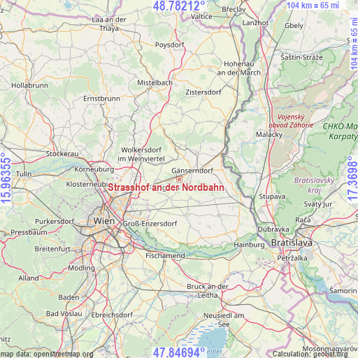
48° 19' 0.012" North, 16° 40' 0.012" East
| Map corner | latitude | longitude |
|---|---|---|
| Upper-left | 48.78212°, | 15.96355° |
| Center: | 48.31667°, | 16.66667° |
| Lower-right: | 47.84694°, | 17.3698° |
| Map W x H: | 104×104 km | = 64.6×64.6mi |
| max Lat: | 48.98333° ⇑13.4% North |
| Strasshof an der Nordbahn: | 48.31667° |
| min Lat: | ⇓86.6% South 46.48841° |
| min Long | Strasshof an de | max Long |
| 9.57802° | 16.66667° | 17.1° |
| W 96.9%⇐ | ⇒3.1% E |
Elevation
Elevation of Strasshof an der Nordbahn is 161 m = 528 ft, and this is 344.5 m = 1130 ft below average elevation for this country.
| Max E: |
2140 m = 7021 ft | 97.2% |
| Avg. | 505.5 m = 1658 ft | |
| Strasshof an der Nordbahn | 161 m = 528 ft | |
Min E: |
118 m = 387 ft | 2.8% |
See also: Austria elevation on elevation.city.
Geographical zone
Strasshof an der Nordbahn is located in North temperate zone (between Tropic of Cancer and the Arctic Circle). Distance of this North polar circle is 2028.9 km =1260.7 mi to North.| Distance of | km | miles | from Strasshof an der Nordbahn |
|---|---|---|---|
| North Pole | 4634.8 | 2879.9 | to North |
| Arctic Circle | 2028.9 | 1260.7 | to North |
| Tropic Cancer | 2766.4 | 1719 | to South |
| Equator | 5372.3 | 3338.2 | to South |


Nearby cities:
15 places around Strasshof an der Nordbahn: (largest is in red/bold)
• Auersthal
6.7 km =4.2 mi,  340°
340°
• Bockfließ
6.7 km =4.2 mi,  316°
316°
• Deutsch-Wagram
7.6 km =4.7 mi,  255°
255°
• Glinzendorf
8.1 km =5 mi,  193°
193°
• Groß-Engersdorf
8.8 km =5.5 mi,  302°
302°
• Großhofen
7.4 km =4.6 mi,  208°
208°
• Gänserndorf
4.7 km =2.9 mi,  57°
57°
• Markgrafneusiedl
6.1 km =3.8 mi,  203°
203°
• Obersiebenbrunn
6.6 km =4.1 mi,  150°
150°
• Parbasdorf
6.2 km =3.9 mi,  233°
233°
• Prottes
9.4 km =5.8 mi,  34°
34°
• Raggendorf
8.6 km =5.3 mi,  355°
355°
• Schönkirchen-Reyersdorf
4.6 km =2.9 mi,  23°
23°
• Untersiebenbrunn
8.9 km =5.5 mi, 146°
• Weikendorf
8 km =5 mi,  67°
67°
Sources, notices
• [Note1] Compared only with cities in Austria existing in our database
• [Src1] Map data: © OpenStreetMap contributors (CC-BY-SA)
• [Src2] Other city data from geonames.org with taken over terms of usage.
• [Src3] Geographical zone / Annual Mean Temperature by Robert A. Rohde @ Wikipedia
