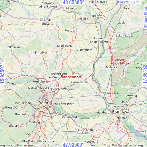
Raggendorf geodata
Raggendorf (Lower Austria) is a populated place; located in Austria in Europe/Vienna (GMT+2) time zone. With population of 629 people, there are 2037 cities with bigger population in this country. Compared to other cities in Austria, 90.4% of cities are located further ↓South; 96.8% of cities are located further ←West and 95.5% of cities have higher elevation than Raggendorf. Note1
Administrative division(s):
- Level 1: Lower Austria
- Level 2: Politischer Bezirk Gänserndorf
- Level 3: Matzen-Raggendorf


Raggendorf GPS coordinates[2]
48° 23' 38.796" North, 16° 39' 29.484" East
| Map corner | latitude | longitude |
|---|---|---|
| Upper-left | 48.85885°, | 15.95507° |
| Center: | 48.39411°, | 16.65819° |
| Lower-right: | 47.92509°, | 17.36132° |
| Map W x H: | 103.8×103.8 km | = 64.5×64.5mi |
| max Lat: | 48.98333° ⇑9.6% North |
| Raggendorf: | 48.39411° |
| min Lat: | ⇓90.4% South 46.48841° |
| min Long | Raggendorf | max Long |
| 9.57802° | 16.65819° | 17.1° |
| W 96.8%⇐ | ⇒3.2% E |
Elevation
Elevation of Raggendorf is 175 m = 574 ft, and this is 330.5 m = 1084 ft below average elevation for this country.
| Max E: |
2140 m = 7021 ft | 95.5% |
| Avg. | 505.5 m = 1658 ft | |
| Raggendorf | 175 m = 574 ft | |
Min E: |
118 m = 387 ft | 4.5% |
See also: Austria elevation on elevation.city.
Geographical zone
Raggendorf is located in North temperate zone (between Tropic of Cancer and the Arctic Circle). Distance of this North polar circle is 2020.3 km =1255.4 mi to North.| Distance of | km | miles | from Raggendorf |
|---|---|---|---|
| North Pole | 4626.1 | 2874.5 | to North |
| Arctic Circle | 2020.3 | 1255.4 | to North |
| Tropic Cancer | 2775 | 1724.3 | to South |
| Equator | 5380.9 | 3343.5 | to South |


Nearby cities:
15 places around Raggendorf: (largest is in red/bold)
• Auersthal
2.8 km =1.7 mi,  215°
215°
• Bad Pirawarth
7.8 km =4.8 mi,  325°
325°
• Bockfließ
5.5 km =3.4 mi,  226°
226°
• Ebenthal
10.2 km =6.3 mi,  64°
64°
• Groß-Engersdorf
7.9 km =4.9 mi,  239°
239°
• Groß-Schweinbarth
3 km =1.9 mi,  319°
319°
• Gänserndorf
7.6 km =4.7 mi,  143°
143°
• Hohenruppersdorf
7.8 km =4.8 mi,  356°
356°
• Matzen
3.2 km =2 mi,  78°
78°
• Pillichsdorf
10.4 km =6.5 mi, 241°
• Prottes
6 km =3.7 mi,  97°
97°
• Schönkirchen-Reyersdorf
5 km =3.1 mi,  150°
150°
• Spannberg
9.7 km =6 mi,  36°
36°
• Strasshof an der Nordbahn
8.6 km =5.3 mi,  175°
175°
• Weikendorf
9.7 km =6 mi,  124°
124°
Sources, notices
• [Note1] Compared only with cities in Austria existing in our database
• [Src1] Map data: © OpenStreetMap contributors (CC-BY-SA)
• [Src2] Other city data from geonames.org with taken over terms of usage.
• [Src3] Geographical zone / Annual Mean Temperature by Robert A. Rohde @ Wikipedia
