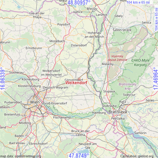
Weikendorf geodata
Weikendorf (Lower Austria) is a seat of a third-order administrative division; located in Austria in Europe/Vienna (GMT+2) time zone. With population of 1,132 people, there are 1123 cities with bigger population in this country. Compared to other cities in Austria, 88% of cities are located further ↓South; 97.9% of cities are located further ←West and 98.4% of cities have higher elevation than Weikendorf. Note1
Administrative division(s):
- Level 1: Lower Austria
- Level 2: Politischer Bezirk Gänserndorf
- Level 3: Weikendorf


Weikendorf GPS coordinates[2]
48° 20' 39.768" North, 16° 45' 59.436" East
| Map corner | latitude | longitude |
|---|---|---|
| Upper-left | 48.80957°, | 16.06339° |
| Center: | 48.34438°, | 16.76651° |
| Lower-right: | 47.8749°, | 17.46964° |
| Map W x H: | 103.9×103.9 km | = 64.6×64.6mi |
| max Lat: | 48.98333° ⇑12% North |
| Weikendorf: | 48.34438° |
| min Lat: | ⇓88% South 46.48841° |
| min Long | Weikendorf | max Long |
| 9.57802° | 16.76651° | 17.1° |
| W 97.9%⇐ | ⇒2.1% E |
Elevation
Elevation of Weikendorf is 150 m = 492 ft, and this is 355.5 m = 1166 ft below average elevation for this country.
| Max E: |
2140 m = 7021 ft | 98.4% |
| Avg. | 505.5 m = 1658 ft | |
| Weikendorf | 150 m = 492 ft | |
Min E: |
118 m = 387 ft | 1.6% |
See also: Austria elevation on elevation.city.
Geographical zone
Weikendorf is located in North temperate zone (between Tropic of Cancer and the Arctic Circle). Distance of this North polar circle is 2025.8 km =1258.8 mi to North.| Distance of | km | miles | from Weikendorf |
|---|---|---|---|
| North Pole | 4631.7 | 2878 | to North |
| Arctic Circle | 2025.8 | 1258.8 | to North |
| Tropic Cancer | 2769.5 | 1720.9 | to South |
| Equator | 5375.4 | 3340.1 | to South |


Nearby cities:
15 places around Weikendorf: (largest is in red/bold)
• Angern an der March
5.9 km =3.7 mi,  50°
50°
• Auersthal
10.2 km =6.3 mi,  288°
288°
• Bockfließ
12.1 km =7.5 mi,  278°
278°
• Ebenthal
10 km =6.2 mi,  7°
7°
• Groß-Schweinbarth
12.6 km =7.8 mi,  308°
308°
• Gänserndorf
3.5 km =2.2 mi,  260°
260°
• Markgrafneusiedl
13.1 km =8.1 mi,  228°
228°
• Matzen
7.9 km =4.9 mi,  321°
321°
• Obersiebenbrunn
9.7 km =6 mi,  205°
205°
• Ollersdorf
6.7 km =4.2 mi,  21°
21°
• Prottes
5.1 km =3.2 mi,  336°
336°
• Raggendorf
9.7 km =6 mi,  304°
304°
• Schönkirchen-Reyersdorf
5.7 km =3.5 mi, 281°
• Strasshof an der Nordbahn
8 km =5 mi,  247°
247°
• Untersiebenbrunn
10.8 km =6.7 mi,  193°
193°
Sources, notices
• [Note1] Compared only with cities in Austria existing in our database
• [Src1] Map data: © OpenStreetMap contributors (CC-BY-SA)
• [Src2] Other city data from geonames.org with taken over terms of usage.
• [Src3] Geographical zone / Annual Mean Temperature by Robert A. Rohde @ Wikipedia
