Glinzendorf geodata
Glinzendorf (Lower Austria) is a seat of a third-order administrative division; located in Austria in Europe/Vienna (GMT+2) time zone. With population of 295 people, there are 2753 cities with bigger population in this country. Compared to other cities in Austria, 82.5% of cities are located further ↓South; 96.6% of cities are located further ←West and 98.3% of cities have higher elevation than Glinzendorf. Note1
Administrative division(s):
- Level 1: Lower Austria
- Level 2: Politischer Bezirk Gänserndorf
- Level 3: Glinzendorf


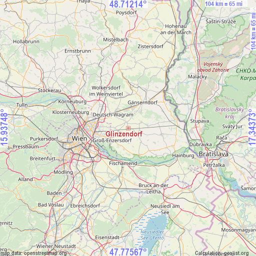
Glinzendorf GPS coordinates[2]
48° 14' 45.78" North, 16° 38' 26.16" East
| Map corner | latitude | longitude |
|---|---|---|
| Upper-left | 48.71214°, | 15.93748° |
| Center: | 48.24605°, | 16.6406° |
| Lower-right: | 47.77567°, | 17.34373° |
| Map W x H: | 104.1×104.1 km | = 64.7×64.7mi |
| max Lat: | 48.98333° ⇑17.5% North |
| Glinzendorf: | 48.24605° |
| min Lat: | ⇓82.5% South 46.48841° |
| min Long | Glinzendorf | max Long |
| 9.57802° | 16.6406° | 17.1° |
| W 96.6%⇐ | ⇒3.4% E |
Elevation
Elevation of Glinzendorf is 151 m = 495 ft, and this is 354.5 m = 1163 ft below average elevation for this country.
| Max E: |
2140 m = 7021 ft | 98.3% |
| Avg. | 505.5 m = 1658 ft | |
| Glinzendorf | 151 m = 495 ft | |
Min E: |
118 m = 387 ft | 1.7% |
See also: Austria elevation on elevation.city.
Geographical zone
Glinzendorf is located in North temperate zone (between Tropic of Cancer and the Arctic Circle). Distance of this North polar circle is 2036.7 km =1265.5 mi to North.| Distance of | km | miles | from Glinzendorf |
|---|---|---|---|
| North Pole | 4642.6 | 2884.8 | to North |
| Arctic Circle | 2036.7 | 1265.5 | to North |
| Tropic Cancer | 2758.5 | 1714.1 | to South |
| Equator | 5364.5 | 3333.3 | to South |


Nearby cities:
15 places around Glinzendorf: (largest is in red/bold)
• Aderklaa
9 km =5.6 mi,  297°
297°
• Andlersdorf
7.2 km =4.5 mi,  164°
164°
• Deutsch-Wagram
8.1 km =5 mi,  317°
317°
• Groß-Enzersdorf
8.2 km =5.1 mi,  234°
234°
• Großhofen
2.1 km =1.3 mi,  311°
311°
• Leopoldsdorf im Marchfelde
4.4 km =2.7 mi,  126°
126°
• Markgrafneusiedl
2.4 km =1.5 mi,  346°
346°
• Oberhausen
8.7 km =5.4 mi,  208°
208°
• Obersiebenbrunn
5.6 km =3.5 mi,  67°
67°
• Parbasdorf
5.1 km =3.2 mi, 324°
• Probstdorf
8.6 km =5.3 mi,  192°
192°
• Raasdorf
5.6 km =3.5 mi,  270°
270°
• Strasshof an der Nordbahn
8.1 km =5 mi,  13°
13°
• Untersiebenbrunn
6.9 km =4.3 mi,  86°
86°
• Wittau
7.8 km =4.8 mi,  204°
204°
Sources, notices
• [Note1] Compared only with cities in Austria existing in our database
• [Src1] Map data: © OpenStreetMap contributors (CC-BY-SA)
• [Src2] Other city data from geonames.org with taken over terms of usage.
• [Src3] Geographical zone / Annual Mean Temperature by Robert A. Rohde @ Wikipedia
