Steinabrückl geodata
Steinabrückl (Lower Austria) is a populated place; located in Austria in Europe/Vienna (GMT+2) time zone. With population of 1,906 people, there are 650 cities with bigger population in this country. Compared to other cities in Austria, 59.7% of cities are located further ↓South; 86.1% of cities are located further ←West and 74.1% of cities have higher elevation than Steinabrückl. Note1
Administrative division(s):
- Level 1: Lower Austria
- Level 2: Politischer Bezirk Wiener Neustadt
- Level 3: Wöllersdorf-Steinabrückl


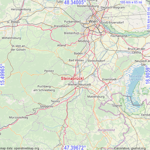
Steinabrückl GPS coordinates[2]
47° 52' 13.908" North, 16° 12' 9.972" East
| Map corner | latitude | longitude |
|---|---|---|
| Upper-left | 48.34005°, | 15.49965° |
| Center: | 47.87053°, | 16.20277° |
| Lower-right: | 47.39672°, | 16.9059° |
| Map W x H: | 104.9×104.9 km | = 65.2×65.2mi |
| max Lat: | 48.98333° ⇑40.3% North |
| Steinabrückl: | 47.87053° |
| min Lat: | ⇓59.7% South 46.48841° |
| min Long | Steinabrückl | max Long |
| 9.57802° | 16.20277° | 17.1° |
| W 86.1%⇐ | ⇒13.9% E |
Elevation
Elevation of Steinabrückl is 309 m = 1014 ft, and this is 196.5 m = 645 ft below average elevation for this country.
| Max E: |
2140 m = 7021 ft | 74.1% |
| Avg. | 505.5 m = 1658 ft | |
| Steinabrückl | 309 m = 1014 ft | |
Min E: |
118 m = 387 ft | 25.9% |
See also: Austria elevation on elevation.city.
Geographical zone
Steinabrückl is located in North temperate zone (between Tropic of Cancer and the Arctic Circle). Distance of this North polar circle is 2078.5 km =1291.5 mi to North.| Distance of | km | miles | from Steinabrückl |
|---|---|---|---|
| North Pole | 4684.4 | 2910.8 | to North |
| Arctic Circle | 2078.5 | 1291.5 | to North |
| Tropic Cancer | 2716.8 | 1688.1 | to South |
| Equator | 5322.7 | 3307.4 | to South |


Nearby cities:
15 places around Steinabrückl: (largest is in red/bold)
• Bad Fischau
5.1 km =3.2 mi,  211°
211°
• Brunn an der Schneebergbahn
6.1 km =3.8 mi, 211°
• Dreistetten
7.8 km =4.8 mi,  257°
257°
• Felixdorf
3.2 km =2 mi,  67°
67°
• Hernstein
7.7 km =4.8 mi,  290°
290°
• Hirtenberg
6.9 km =4.3 mi,  345°
345°
• Leobersdorf
6.5 km =4 mi,  9°
9°
• Markt Piesting
5.8 km =3.6 mi,  273°
273°
• Matzendorf
2.5 km =1.6 mi,  19°
19°
• Muthmannsdorf
7.8 km =4.8 mi,  242°
242°
• Siebenhaus
7.4 km =4.6 mi, 15°
• Sollenau
4.6 km =2.9 mi,  47°
47°
• Theresienfeld
3.2 km =2 mi,  135°
135°
• Wiener Neustadt
7.6 km =4.7 mi,  163°
163°
• Wöllersdorf
2.4 km =1.5 mi, 255°
Sources, notices
• [Note1] Compared only with cities in Austria existing in our database
• [Src1] Map data: © OpenStreetMap contributors (CC-BY-SA)
• [Src2] Other city data from geonames.org with taken over terms of usage.
• [Src3] Geographical zone / Annual Mean Temperature by Robert A. Rohde @ Wikipedia
