Leobersdorf geodata
Leobersdorf (Lower Austria) is a seat of a third-order administrative division; located in Austria in Europe/Vienna (GMT+2) time zone. With population of 4,915 people, there are 196 cities with bigger population in this country. Compared to other cities in Austria, 62% of cities are located further ↓South; 86.5% of cities are located further ←West and 81.7% of cities have higher elevation than Leobersdorf. Note1
Administrative division(s):
- Level 1: Lower Austria
- Level 2: Politischer Bezirk Baden
- Level 3: Leobersdorf


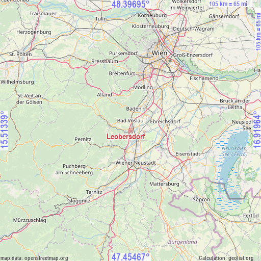
Leobersdorf GPS coordinates[2]
47° 55' 40.656" North, 16° 12' 59.436" East
| Map corner | latitude | longitude |
|---|---|---|
| Upper-left | 48.39695°, | 15.51339° |
| Center: | 47.92796°, | 16.21651° |
| Lower-right: | 47.45467°, | 16.91964° |
| Map W x H: | 104.8×104.8 km | = 65.1×65.1mi |
| max Lat: | 48.98333° ⇑38% North |
| Leobersdorf: | 47.92796° |
| min Lat: | ⇓62% South 46.48841° |
| min Long | Leobersdorf | max Long |
| 9.57802° | 16.21651° | 17.1° |
| W 86.5%⇐ | ⇒13.5% E |
Elevation
Elevation of Leobersdorf is 267 m = 876 ft, and this is 238.5 m = 782 ft below average elevation for this country.
| Max E: |
2140 m = 7021 ft | 81.7% |
| Avg. | 505.5 m = 1658 ft | |
| Leobersdorf | 267 m = 876 ft | |
Min E: |
118 m = 387 ft | 18.3% |
See also: Austria elevation on elevation.city.
Geographical zone
Leobersdorf is located in North temperate zone (between Tropic of Cancer and the Arctic Circle). Distance of this North polar circle is 2072.1 km =1287.5 mi to North.| Distance of | km | miles | from Leobersdorf |
|---|---|---|---|
| North Pole | 4678 | 2906.8 | to North |
| Arctic Circle | 2072.1 | 1287.5 | to North |
| Tropic Cancer | 2723.2 | 1692.1 | to South |
| Equator | 5329.1 | 3311.3 | to South |


Nearby cities:
15 places around Leobersdorf: (largest is in red/bold)
• Bad Vöslau
4.2 km =2.6 mi,  357°
357°
• Felixdorf
5.5 km =3.4 mi,  159°
159°
• Gainfarn
4.2 km =2.6 mi,  336°
336°
• Großau
4.7 km =2.9 mi,  310°
310°
• Günselsdorf
3.7 km =2.3 mi,  61°
61°
• Hirtenberg
2.8 km =1.7 mi,  276°
276°
• Kottingbrunn
2.7 km =1.7 mi,  17°
17°
• Matzendorf
4.1 km =2.5 mi,  182°
182°
• Schönau an der Triesting
2.9 km =1.8 mi,  75°
75°
• Siebenhaus
1.2 km =0.7 mi,  50°
50°
• Sollenau
4.1 km =2.5 mi,  144°
144°
• Sooss
6.3 km =3.9 mi,  0°
0°
• Steinabrückl
6.5 km =4 mi,  189°
189°
• Tattendorf
6.7 km =4.2 mi,  68°
68°
• Teesdorf
5.5 km =3.4 mi, 63°
Sources, notices
• [Note1] Compared only with cities in Austria existing in our database
• [Src1] Map data: © OpenStreetMap contributors (CC-BY-SA)
• [Src2] Other city data from geonames.org with taken over terms of usage.
• [Src3] Geographical zone / Annual Mean Temperature by Robert A. Rohde @ Wikipedia
